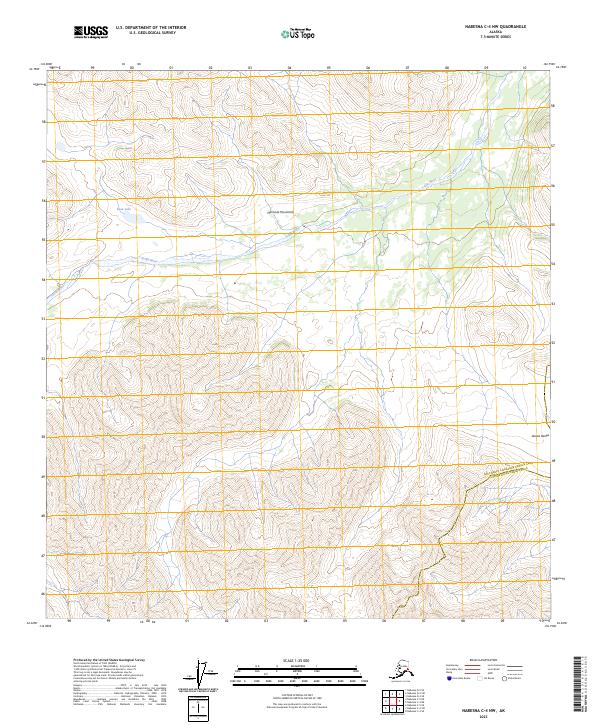
2023 Map of Nabesna C-4 NW
USGS Topo · Published 2023About this map
The Tetlin River winds through this interior Alaskan wilderness, cutting between the rising slopes of the Mentasta Mountains and the northern reaches of the Alaska Range. This landscape is defined by its dramatic elevation changes and sparse human footprint, with the southeastern corner of the quadrangle preserved within the Tetlin National Wildlife Refuge. The map captures the complex drainage patterns of the river valley, where Bean Lake sits north of the main channel. Positioned at the boundary of the Southeast Fairbanks Census Area and Copper River Census Area, the sheet provides a meticulous view of the area's topography, illustrating the transition from riverine wetlands to high mountain peaks.
Find a feature on this map
10 named features on this map. Tap any name to fly to it.
Don’t see what you’re looking for? This feature index may not catch every label — zoom into the map to look around manually.
Map Details
Editions of this 2023 Nabesna C-4 NW Map
This is the sole edition of this map. No revisions or reprints were ever made.
Other maps of this area

1948 · Nabesna D-5
USGS Topo · 1:63,360

1950 · Nabesna
USGS Topo · 1:250,000

1950 · Nabesna D-5
USGS Topo · 1:63,360

1951 · Nabesna
USGS Topo · 1:250,000

1952 · Nabesna D-5
USGS Topo · 1:63,360

1954 · Nabesna D-4
USGS Topo · 1:63,360

1957 · Nabesna C-5
USGS Topo · 1:63,360
1960 · Nabesna D-4
USGS Topo · 1:63,360

1960 · Nabesna
USGS Topo · 1:250,000

1960 · Nabesna C-4
USGS Topo · 1:63,360