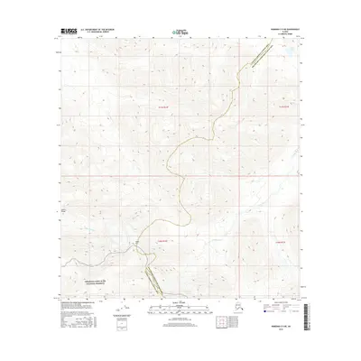
2016 Map of Nabesna C-5 NE
USGS Topo · Published 2016About this map
Wrangell-Saint Elias National Preserve anchors the southern portion of this landscape, where the high country of the Alaska Range gives way to a network of drainage basins. The high point of Noyes Mtn overlooks a terrain defined by the headwaters and winding paths of the Tetlin River and Little Tok River. In the northeast corner, Bear Lake sits near the administrative divide between the Valdez-Cordova and Southeast Fairbanks census areas. This 2016 survey documents a largely roadless interior, emphasizing the natural topography and waterway systems that dictate movement and land use in this remote Alaskan region.
Find a feature on this map
12 named features on this map. Tap any name to fly to it.
Don’t see what you’re looking for? This feature index may not catch every label — zoom into the map to look around manually.
Map Details
Editions of this 2016 Nabesna C-5 NE Map
This is the sole edition of this map. No revisions or reprints were ever made.
Other maps of this area

1948 · Nabesna D-5
USGS Topo · 1:63,360

1950 · Nabesna
USGS Topo · 1:250,000

1950 · Nabesna D-5
USGS Topo · 1:63,360

1951 · Nabesna
USGS Topo · 1:250,000

1952 · Nabesna D-5
USGS Topo · 1:63,360

1954 · Nabesna D-4
USGS Topo · 1:63,360

1957 · Nabesna C-5
USGS Topo · 1:63,360
1960 · Nabesna D-4
USGS Topo · 1:63,360

1960 · Nabesna
USGS Topo · 1:250,000

1960 · Nabesna C-4
USGS Topo · 1:63,360