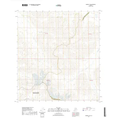
2019 Map of Nabesna C-5 NE
USGS Topo · Published 2019About this map
Mentasta Mountains dominate this high-altitude landscape, where sharp topographic relief defines the border between the Valdez-Cordova and Southeast Fairbanks census areas. The southern portion of the map is protected as part of the Wrangell-St. Elias National Preserve, a region where glacier-fed waters like Lost Cr and the headwaters of the Tetlin River begin their descent. Near Noyes Mtn, the Trail Creek To Lost Creek Route provides a rare designated passage through the elevation changes. The drainage patterns of the Little Tok River and the isolated waters of Bear Lake in the northeast corner illustrate the complex hydrology of this subarctic environment. The lack of permanent structures emphasizes the wilderness character of the terrain, leaving only the ancient mountain peaks and winding river valleys as the primary landmarks.
Find a feature on this map
14 named features on this map. Tap any name to fly to it.
Don’t see what you’re looking for? This feature index may not catch every label — zoom into the map to look around manually.
Map Details
Editions of this 2019 Nabesna C-5 NE Map
This is the sole edition of this map. No revisions or reprints were ever made.
Other maps of this area

1948 · Nabesna D-5
USGS Topo · 1:63,360

1950 · Nabesna
USGS Topo · 1:250,000

1950 · Nabesna D-5
USGS Topo · 1:63,360

1951 · Nabesna
USGS Topo · 1:250,000

1952 · Nabesna D-5
USGS Topo · 1:63,360

1954 · Nabesna D-4
USGS Topo · 1:63,360

1957 · Nabesna C-5
USGS Topo · 1:63,360
1960 · Nabesna D-4
USGS Topo · 1:63,360

1960 · Nabesna
USGS Topo · 1:250,000

1960 · Nabesna C-4
USGS Topo · 1:63,360