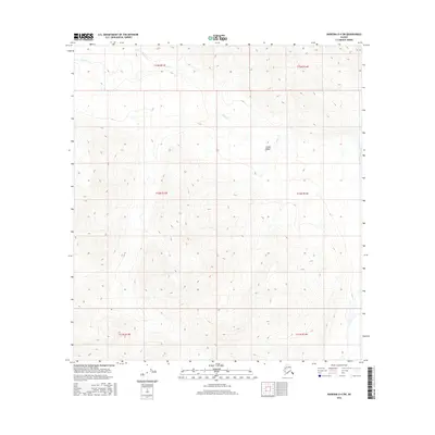
2016 Map of Nabesna D-4 SW
USGS Topo · Published 2016About this map
The Alaska Range dominates this portion of the Unorganized Borough, where steep elevation gradients and glacial drainage patterns define the landscape. This 2016 survey highlights the intricate network of alpine waterways, specifically the headwaters and tributaries of Tuck Cr and Moose Cr. The terrain is marked by significant vertical relief, typical of the high-latitude interior. The map illustrates a wilderness largely untouched by permanent settlement or road infrastructure, structured instead by the township and range lines of the Public Land Survey System, including t12n r13e and t13n r14e. This cartography provides a baseline for studying the shifting hydrology and geomorphology of the Alaskan interior, showing how water systems like Moose Cr navigate the high-elevation valleys.
Find a feature on this map
9 named features on this map. Tap any name to fly to it.
Don’t see what you’re looking for? This feature index may not catch every label — zoom into the map to look around manually.
Map Details
Editions of this 2016 Nabesna D-4 SW Map
This is the sole edition of this map. No revisions or reprints were ever made.
Other maps of this area

1948 · Nabesna D-5
USGS Topo · 1:63,360

1950 · Nabesna
USGS Topo · 1:250,000

1950 · Nabesna D-5
USGS Topo · 1:63,360

1951 · Nabesna
USGS Topo · 1:250,000

1952 · Nabesna D-5
USGS Topo · 1:63,360

1954 · Nabesna D-4
USGS Topo · 1:63,360

1957 · Nabesna C-5
USGS Topo · 1:63,360
1960 · Nabesna D-4
USGS Topo · 1:63,360

1960 · Nabesna
USGS Topo · 1:250,000

1960 · Nabesna C-4
USGS Topo · 1:63,360