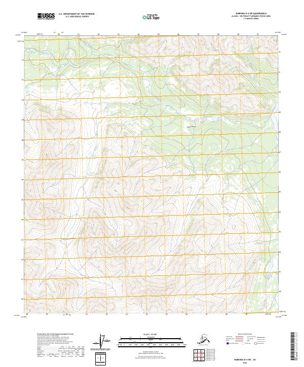
2023 Map of Nabesna D-4 SW
USGS Topo · Published 2023About this map
The Alaska Range and the Mentasta Mountains dominate this high-altitude landscape in the Southeast Fairbanks Census Area. This terrain is defined by its dramatic relief and the headwaters of several significant drainages, including the southeast-flowing Tetlin River. Waterways like Tuck Creek and Moose Creek carve through the northern sections of the sheet, illustrating the natural hydrological patterns of the interior before they reach larger river systems. This 2023 edition provides a modern topographic record of these remote peaks and valleys, showing the intersection of several townships including t13n r13e and t12n r14e. The map remains focused on the physical geography of the wilderness, with no road infrastructure or permanent settlements indicated within these specific survey boundaries.
Find a feature on this map
11 named features on this map. Tap any name to fly to it.
Don’t see what you’re looking for? This feature index may not catch every label — zoom into the map to look around manually.
Map Details
Editions of this 2023 Nabesna D-4 SW Map
This is the sole edition of this map. No revisions or reprints were ever made.
Other maps of this area

1948 · Nabesna D-5
USGS Topo · 1:63,360

1950 · Nabesna
USGS Topo · 1:250,000

1950 · Nabesna D-5
USGS Topo · 1:63,360

1951 · Nabesna
USGS Topo · 1:250,000

1952 · Nabesna D-5
USGS Topo · 1:63,360

1954 · Nabesna D-4
USGS Topo · 1:63,360

1957 · Nabesna C-5
USGS Topo · 1:63,360
1960 · Nabesna D-4
USGS Topo · 1:63,360

1960 · Nabesna
USGS Topo · 1:250,000

1960 · Nabesna C-4
USGS Topo · 1:63,360