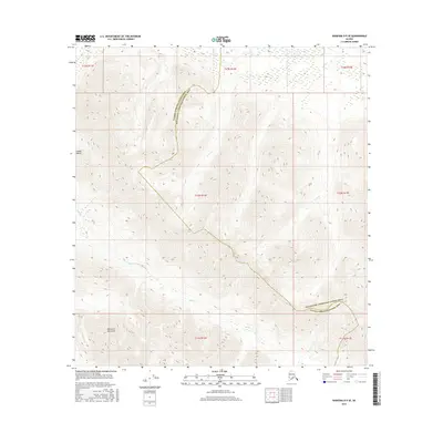
2016 Map of Nabesna D-5 SE
USGS Topo · Published 2016About this map
Alaska Range peaks dominate the northern reaches of this topographic survey, where high-altitude ridges give way to the Mentasta Mountains in the south. This terrain is defined by its drainage patterns, notably where the headwaters of Tuck Cr and Buck Cr carve through deep glacial valleys. The boundary between the Southeast Fairbanks and Valdez-Cordova census areas traverses the center of the sheet, following a serpentine path along the drainage divide. This layout provides a clear view of the natural barriers that have historically dictated administrative lines in the Alaskan interior, showing a landscape almost entirely shaped by elevation and water flow rather than human development or road networks.
Find a feature on this map
13 named features on this map. Tap any name to fly to it.
Don’t see what you’re looking for? This feature index may not catch every label — zoom into the map to look around manually.
Map Details
Editions of this 2016 Nabesna D-5 SE Map
This is the sole edition of this map. No revisions or reprints were ever made.
Other maps of this area

1948 · Nabesna D-5
USGS Topo · 1:63,360

1950 · Nabesna
USGS Topo · 1:250,000

1950 · Nabesna D-5
USGS Topo · 1:63,360

1951 · Nabesna
USGS Topo · 1:250,000

1952 · Nabesna D-5
USGS Topo · 1:63,360

1954 · Nabesna D-4
USGS Topo · 1:63,360

1957 · Nabesna C-5
USGS Topo · 1:63,360
1960 · Nabesna D-4
USGS Topo · 1:63,360

1960 · Nabesna
USGS Topo · 1:250,000

1960 · Nabesna C-4
USGS Topo · 1:63,360