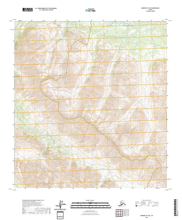
2023 Map of Nabesna D-5 SE
USGS Topo · Published 2023About this map
The Mentasta Mountains and the Alaska Range converge in this high-altitude landscape within the Copper River Census Area and Southeast Fairbanks Census Area. The topography is defined by intense elevation changes, with the northern boundary marked by the flow of Tuck Creek and the western reaches drained by Buck Creek. This is a terrain of immense scale where natural drainages dictate the geography, providing a clear look at the headwaters and high ridges that separate these two major Alaskan regions. The map illustrates the uninhabited wilderness of the interior, focused purely on the intricate contour patterns of the summits and the glacial-fed stream systems that carve through the mountain passes.
Find a feature on this map
12 named features on this map. Tap any name to fly to it.
Don’t see what you’re looking for? This feature index may not catch every label — zoom into the map to look around manually.
Map Details
Editions of this 2023 Nabesna D-5 SE Map
This is the sole edition of this map. No revisions or reprints were ever made.
Other maps of this area

1948 · Nabesna D-5
USGS Topo · 1:63,360

1950 · Nabesna
USGS Topo · 1:250,000

1950 · Nabesna D-5
USGS Topo · 1:63,360

1951 · Nabesna
USGS Topo · 1:250,000

1952 · Nabesna D-5
USGS Topo · 1:63,360

1954 · Nabesna D-4
USGS Topo · 1:63,360

1957 · Nabesna C-5
USGS Topo · 1:63,360
1960 · Nabesna D-4
USGS Topo · 1:63,360

1960 · Nabesna
USGS Topo · 1:250,000

1960 · Nabesna C-4
USGS Topo · 1:63,360