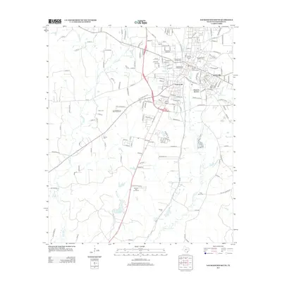
2013 Map of Nacogdoches South
USGS Topo · Published 2013About this map
Sterne-Hoya Historic District and the Zion Hill Historic District anchor the northern reaches of this East Texas survey, where the historic core of the city meets the campus of Stephen F Austin State Univ. The landscape transitions from these established urban neighborhoods toward more industrial and aviation-oriented land use to the south and west. The presence of the Southern Pacific Railroad Depot and Hayward Junction underscores the area's long-standing connection to rail commerce, while the A L Mangham Jr Regional Airport reflects mid-century infrastructure growth.
Find a feature on this map
145 named features on this map. Tap any name to fly to it.
Don’t see what you’re looking for? This feature index may not catch every label — zoom into the map to look around manually.
Map Details
Editions of this 2013 Nacogdoches South Map
This is the sole edition of this map. No revisions or reprints were ever made.
Other maps of this area

1949 · Lufkin
USGS Topo · 1:62,500

1949 · Platt
USGS Topo · 1:24,000

1949 · Clawson
USGS Topo · 1:24,000

1950 · Platt
USGS Topo · 1:24,000

1950 · Clawson
USGS Topo · 1:24,000

1950 · Redland
USGS Topo · 1:24,000

1952 · Douglass
USGS Topo · 1:62,500

1952 · Nacogdoches
USGS Topo · 1:62,500

1953 · Palestine
USGS Topo · 1:250,000

1957 · Palestine
USGS Topo · 1:250,000
Featured Places
- Nacogdoches, TX
- Hayward Junction, Nacogdoches
- Fredonia Hill, Nacogdoches
- Orton Hill, Nacogdoches
- Nacogdoches County, TX