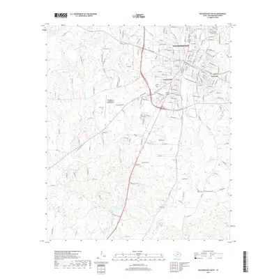
2019 Map of Nacogdoches South
USGS Topo · Published 2019About this map
Nacogdoches serves as the focal point of this 2019 survey, illustrating the southward expansion of the city into the surrounding Piney Woods landscape. The urban street grid transitions into rolling terrain marked by significant water features like Bayou La Nana and Bonita Cr. Local elevation is noted at established neighborhoods such as Fredonia Hill and Orton Hill, which overlook the developing corridors near the Nacogdoches A L Mangham Jr Regional Airport.
Find a feature on this map
182 named features on this map. Tap any name to fly to it.
Don’t see what you’re looking for? This feature index may not catch every label — zoom into the map to look around manually.
Map Details
Editions of this 2019 Nacogdoches South Map
This is the sole edition of this map. No revisions or reprints were ever made.
Other maps of this area

1949 · Lufkin
USGS Topo · 1:62,500

1949 · Platt
USGS Topo · 1:24,000

1949 · Clawson
USGS Topo · 1:24,000

1950 · Platt
USGS Topo · 1:24,000

1950 · Clawson
USGS Topo · 1:24,000

1950 · Redland
USGS Topo · 1:24,000

1952 · Douglass
USGS Topo · 1:62,500

1952 · Nacogdoches
USGS Topo · 1:62,500

1953 · Palestine
USGS Topo · 1:250,000

1957 · Palestine
USGS Topo · 1:250,000
Featured Places
- Nacogdoches, TX
- Hayward Junction, Nacogdoches
- Fredonia Hill, Nacogdoches
- Orton Hill, Nacogdoches
- Nacogdoches County, TX