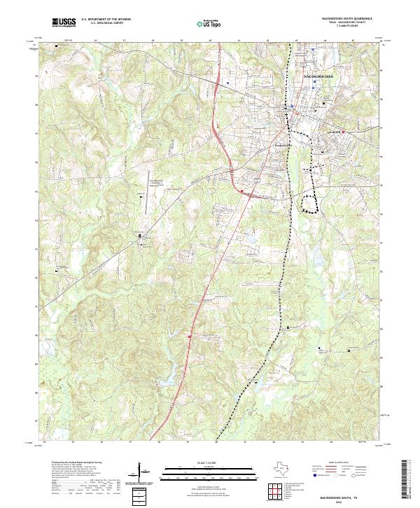
2022 Map of Nacogdoches South
USGS Topo · Published 2022About this map
Nacogdoches serves as the focal point of this East Texas survey, revealing a landscape where historic urban neighborhoods meet the creek-fed lowlands of the Pineywoods. The town’s heritage is etched into the map through its numerous burial grounds, including the centrally located Oak Grove Cemetery and the Zion Hill Baptist Church Cemetery. To the south and west, the terrain is defined by the winding paths of Bayou La Nana and Moral Bayou, which weave through a network of rural roads such as FM 225 and County Road 719. Significant landmarks like Stephen F Austin State University and the Nacogdoches County Courthouse anchor the northern portion, while the Nacogdoches A L Mangham Jr Regional Airport marks the transition toward more open country. Notable local elevations such as Fredonia Hill, Orton Hill, and the geographic feature of Spanish Bluff provide a look at the area's physical character and historic settlement patterns.
Find a feature on this map
178 named features on this map. Tap any name to fly to it.
Don’t see what you’re looking for? This feature index may not catch every label — zoom into the map to look around manually.
Map Details
Editions of this 2022 Nacogdoches South Map
This is the sole edition of this map. No revisions or reprints were ever made.
Other maps of this area

1949 · Lufkin
USGS Topo · 1:62,500

1949 · Platt
USGS Topo · 1:24,000

1949 · Clawson
USGS Topo · 1:24,000

1950 · Platt
USGS Topo · 1:24,000

1950 · Clawson
USGS Topo · 1:24,000

1950 · Redland
USGS Topo · 1:24,000

1952 · Douglass
USGS Topo · 1:62,500

1952 · Nacogdoches
USGS Topo · 1:62,500

1953 · Palestine
USGS Topo · 1:250,000

1957 · Palestine
USGS Topo · 1:250,000
Featured Places
- Nacogdoches, TX
- Hayward Junction, Nacogdoches
- Fredonia Hill, Nacogdoches
- Orton Hill, Nacogdoches
- Nacogdoches County, TX