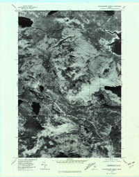
1978 Map of Nahamakanta Stream
USGS Topo · Published 1981About this map
Nahamakanta Lake dominates the northwestern corner of this Piscataquis County landscape, where the Maine woods are defined by an intricate network of glacial lakes and drainage streams. Based on aerial photography from the late 1970s, this orthophotoquad provides a direct visual record of the forest canopy and shorelines before modern development or changing timber management practices altered the terrain. The sheet captures the massive expanse of Pemadumcook Lake on the eastern edge and the elevated spine of Potaywadjo Ridge. Waterways such as Pratt Brook and Cooper Brook carve through the timberland, connecting smaller water bodies like Henderson Pond and Cooper Pond to the larger drainage systems. This imagery is particularly valuable for identifying historic logging roads and the natural contours of Cooper Mountain in a period of relative isolation.
Find a feature on this map
11 named features on this map. Tap any name to fly to it.
Don’t see what you’re looking for? This feature index may not catch every label — zoom into the map to look around manually.
Map Details
Editions of this 1978 Nahamakanta Stream Map
This is the sole edition of this map. No revisions or reprints were ever made.
Other maps of this area

1927 · Katahdin
USGS Topo · 1:48,000

1930 · Katahdin
USGS Topo · 1:62,500

1949 · Katahdin
USGS Topo · 1:62,500

1951 · Norcross
USGS Topo · 1:62,500

1952 · Jo-Mary Mountain
USGS Topo · 1:62,500

1954 · Harrington Lake
USGS Topo · 1:62,500

1954 · Millinocket
USGS Topo · 1:250,000

1958 · Millinocket
USGS Topo · 1:250,000

1960 · Millinocket
USGS Topo · 1:250,000
1978 · Rainbow Lake West
USGS Topo · 1:24,000