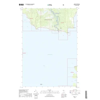
2019 Map of Nahma
USGS Topo · Published 2019About this map
Nahma sits at the southern edge of the Hiawatha National Forest on the Upper Peninsula, where the Sturgeon Wild and Scenic River meets the northern reaches of Lake Michigan. This coastal landscape is defined by the transition from dense forest and extensive wetlands like Nahma Marsh to the jagged shoreline of Big Bay de Noc. The settlement patterns here are closely tied to the water, with the Sturgeon River Canoe Route tracing a path through the timberlands down to the bay. Along the coast, significant geographical markers such as Indian Point, Stony Point, and the prominent Garden Bluff to the south define the maritime character of Delta County. This map preserves the local layout of the community, including the Nahma Cem and the local Po, providing a clear record of this timber and water-dependent region in the early 21st century.
Find a feature on this map
22 named features on this map. Tap any name to fly to it.
Don’t see what you’re looking for? This feature index may not catch every label — zoom into the map to look around manually.
Map Details
Editions of this 2019 Nahma Map
This is the sole edition of this map. No revisions or reprints were ever made.
Other maps of this area

1932 · Rapid River NE
USGS Topo · 1:31,680

1932 · Burnt Bluff NE
USGS Topo · 1:31,680

1932 · Burnt Bluff NW
USGS Topo · 1:31,680

1932 · Garden NW and SW
USGS Topo · 1:31,680

1932 · Garden SE
USGS Topo · 1:31,680

1932 · Rapid River SE
USGS Topo · 1:31,680

1932 · Garden NE
USGS Topo · 1:31,680

1954 · Escanaba
USGS Topo · 1:250,000

1957 · Escanaba
USGS Topo · 1:250,000

1958 · Escanaba
USGS Topo · 1:250,000