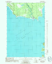
1985 Map of Nahma
USGS Topo · Published 1985About this map
Nahma sits at the northern edge of Big Bay De Noc, where the Sturgeon River flows into the waters of Lake Michigan. This mid-1980s survey captures the coastal character of Delta County, dominated by the Hiawatha National Forest and its winding watercourses like Bull Creek and Marsh Lake. The map reveals a landscape shaped by both nature and industry, noting a Gravel Pit near the shoreline and the prominent heights of Garden Bluff to the southeast. Genealogists and local historians can locate the Indian Point Cem situated near the tip of Indian Point, providing a specific geographic anchor for early settlement history in the region. The coastal boundary is further defined by Poplar Point and Stony Point, marking the transition from protected bays to the open lake.
Find a feature on this map
23 named features on this map. Tap any name to fly to it.
Don’t see what you’re looking for? This feature index may not catch every label — zoom into the map to look around manually.
Map Details
Editions of this 1985 Nahma Map
This is the sole edition of this map. No revisions or reprints were ever made.
Other maps of this area

1932 · Rapid River NE
USGS Topo · 1:31,680

1932 · Burnt Bluff NE
USGS Topo · 1:31,680

1932 · Burnt Bluff NW
USGS Topo · 1:31,680

1932 · Garden NW and SW
USGS Topo · 1:31,680

1932 · Garden SE
USGS Topo · 1:31,680

1932 · Rapid River SE
USGS Topo · 1:31,680

1932 · Garden NE
USGS Topo · 1:31,680

1954 · Escanaba
USGS Topo · 1:250,000

1957 · Escanaba
USGS Topo · 1:250,000

1958 · Escanaba
USGS Topo · 1:250,000