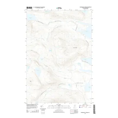
2014 Map of Nahmakanta Stream
USGS Topo · Published 2014About this map
The Appalachian National Scenic Trail winds through this heavily forested landscape in Piscataquis County, crossing prominent elevations and skirting remote water bodies. The terrain is defined by the high ground of Potaywadjo Ridge and the southwestern rise of Cooper Mtn. A complex network of drainage feeds into major bodies like Nahmakanta Lake, Jo-Mary Lake, and the sprawling Pemadumcook Lake to the east.
Find a feature on this map
25 named features on this map. Tap any name to fly to it.
Don’t see what you’re looking for? This feature index may not catch every label — zoom into the map to look around manually.
Map Details
Editions of this 2014 Nahmakanta Stream Map
This is the sole edition of this map. No revisions or reprints were ever made.
Other maps of this area

1927 · Katahdin
USGS Topo · 1:48,000

1930 · Katahdin
USGS Topo · 1:62,500

1949 · Katahdin
USGS Topo · 1:62,500

1951 · Norcross
USGS Topo · 1:62,500

1952 · Jo-Mary Mountain
USGS Topo · 1:62,500

1954 · Harrington Lake
USGS Topo · 1:62,500

1954 · Millinocket
USGS Topo · 1:250,000

1958 · Millinocket
USGS Topo · 1:250,000

1960 · Millinocket
USGS Topo · 1:250,000
1978 · Rainbow Lake West
USGS Topo · 1:24,000