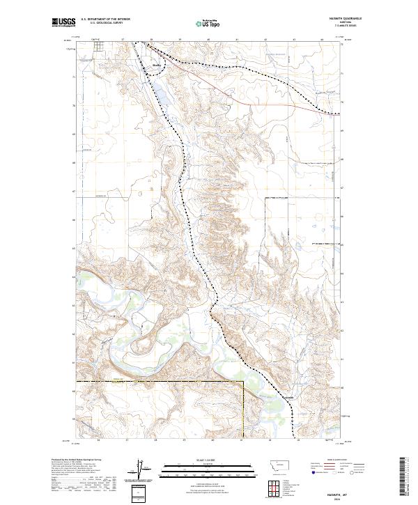
2024 Map of Naismith
USGS Topo · Published 2024About this map
The Marias River carves a winding path through this northern Montana landscape, creating a series of dramatic meanders and breaks across the boundary of Toole and Pondera Counties. The terrain is defined by the sharp transition from the level high plains down into complex drainage systems like Hilger Coulee and Pearson Coulee. While the city of Shelby sits at the northern edge, the eponymous settlement of Naismith is positioned near the river, illustrating the historical importance of water access in this semi-arid region. Rural life is traced through an extensive network of family-named roads such as Fretheim Rd, Underdal Rd, and Kraft Rd, alongside managed water resources like Summers Reservoir and Ovens Reservoir that support the local agricultural economy.
Find a feature on this map
25 named features on this map. Tap any name to fly to it.
Don’t see what you’re looking for? This feature index may not catch every label — zoom into the map to look around manually.
Map Details
Editions of this 2024 Naismith Map
This is the sole edition of this map. No revisions or reprints were ever made.
Other maps of this area

1920 · Conrad
USGS Topo · 1:125,000

1943 · Antelope Coulee
USGS Topo · 1:62,500

1943 · Shelby
USGS Topo · 1:62,500

1954 · Shelby
USGS Topo · 1:250,000

1958 · Shelby
USGS Topo · 1:250,000

1967 · Naismith
USGS Topo · 1:24,000

1967 · Conrad Butte
USGS Topo · 1:24,000

1967 · Dunkirk
USGS Topo · 1:24,000
1967 · Pioneer School
USGS Topo · 1:24,000
1967 · Ledger NW
USGS Topo · 1:24,000