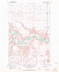
1967 Map of Ledger NW
USGS Topo · Published 1971About this map
The Marias River carves a deep, sinuous path through this High Plains landscape along the border of Toole and Pondera counties. The river valley is a focal point for both history and recreation, containing the Marias Valley Golf and Country Club and Williamson Park. The historical importance of this corridor is underscored by the Lewis and Clark Trail, which tracks across the northern and southern plains above the river bluffs.
Find a feature on this map
14 named features on this map. Tap any name to fly to it.
Don’t see what you’re looking for? This feature index may not catch every label — zoom into the map to look around manually.
Map Details
Editions of this 1967 Ledger NW Map
This is the sole edition of this map. No revisions or reprints were ever made.
Other maps of this area

1909 · Cut Bank
USGS Topo · 1:125,000

1912 · Cut Bank
USGS Topo · 1:125,000

1920 · Dupuyer
USGS Topo · 1:125,000

1920 · Conrad
USGS Topo · 1:125,000

1934 · Valier
USGS Topo · 1:62,500

1937 · Valier
USGS Topo · 1:62,500

1943 · Shelby
USGS Topo · 1:62,500

1954 · Shelby
USGS Topo · 1:250,000

1958 · Shelby
USGS Topo · 1:250,000

1960 · Cut Bank
USGS Topo · 1:250,000