Loading...
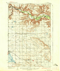
Loading map...1937 Map of Valier
USGS Topo · Published 1937About this map
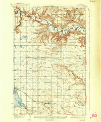
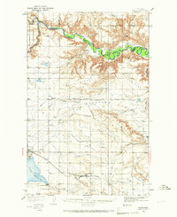
The Marias River carves a winding path across this northern Montana landscape, marking the northern boundary of Pondera County and separating it from Glacier and Toole counties. The town of Valier stands as the primary hub, situated near the shores of Lake Frances, which is managed by the Lake Frances Dam. The region is defined by an extensive irrigation network, with numerous Canals and the Bullhead Drop facilitating agricultural development across the plains.
Find a feature on this map
47 named features on this map. Tap any name to fly to it.
Don’t see what you’re looking for? This feature index may not catch every label — zoom into the map to look around manually.
Map Details
Date Portrayed1937
Date Published1937
PublisherU.S. Geological Survey
Map TypeTopographic
Scale1:62,500
Physical Dimensions16.6 x 19.8 inches
Editions of this 1937 Valier Map
2 editions found
Historical Maps of Valier Through Time
Featured Locations
Source Details
SourceU.S. Geological Survey
CopyrightPublic Domain