
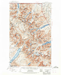
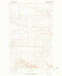
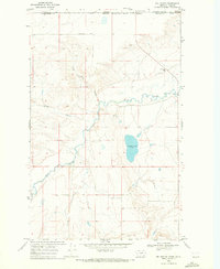
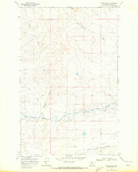
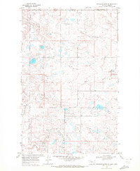
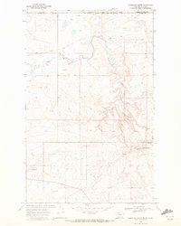
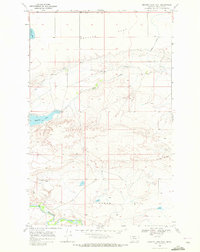
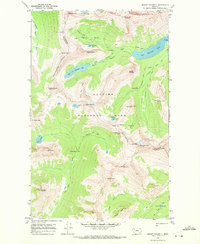
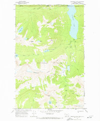
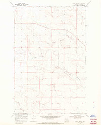
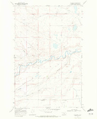
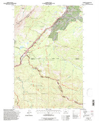
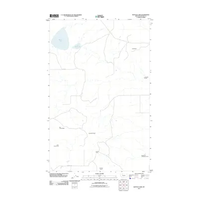
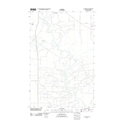
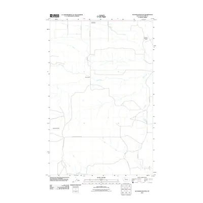
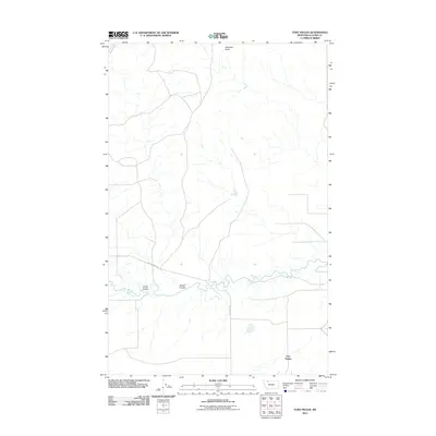
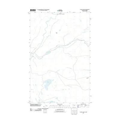
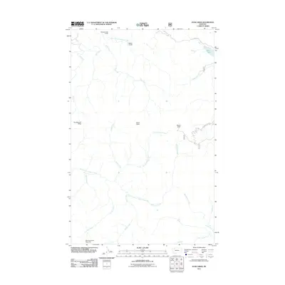
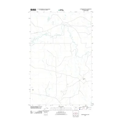
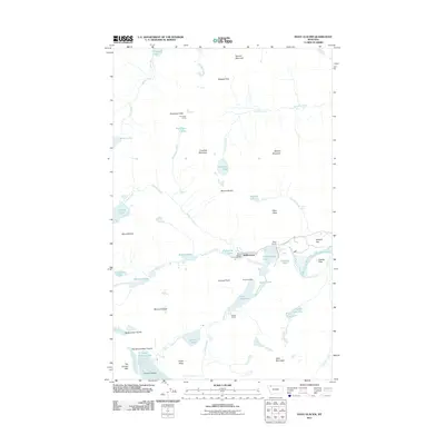
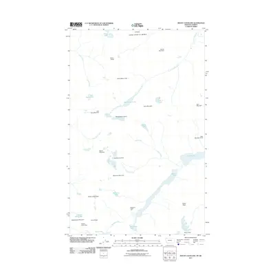
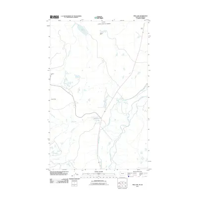
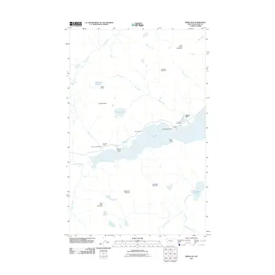
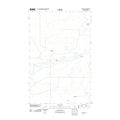
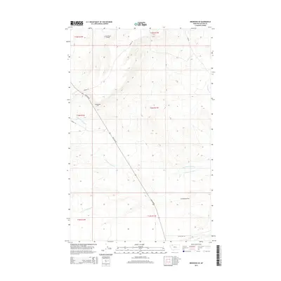
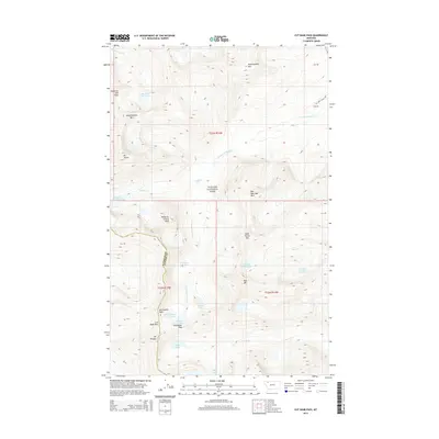
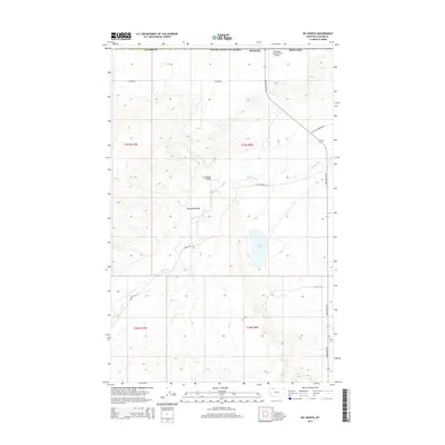
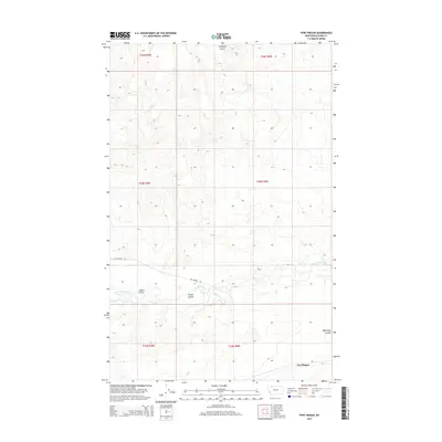
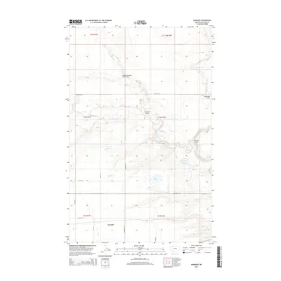
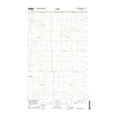
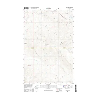
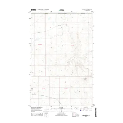
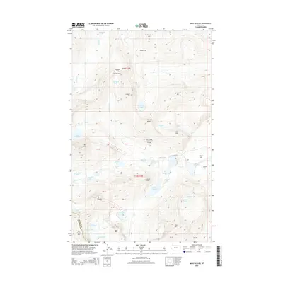
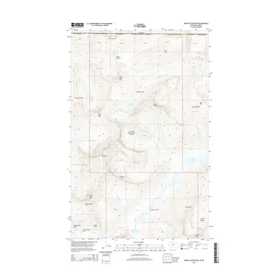
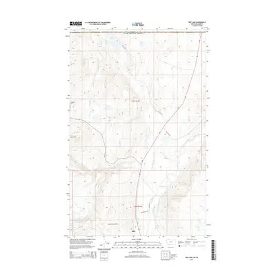
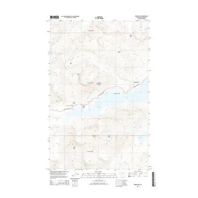
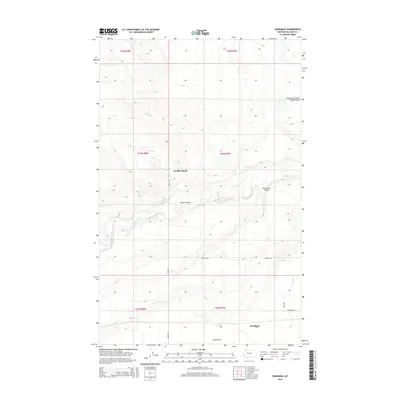
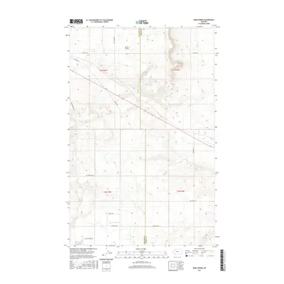
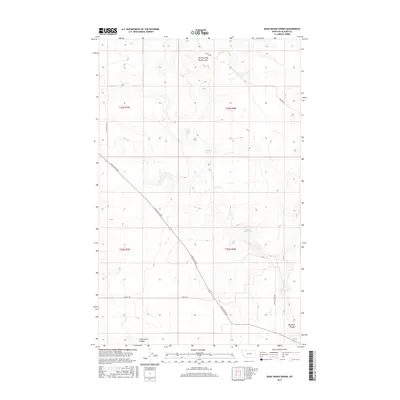
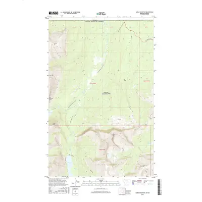
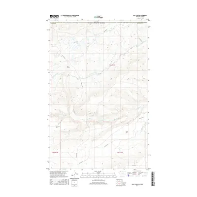
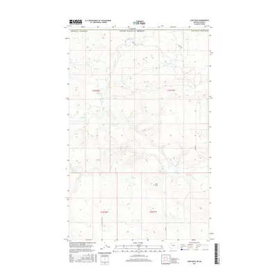
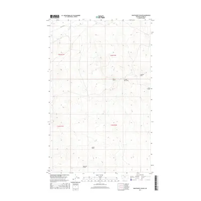
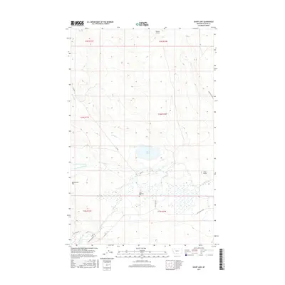
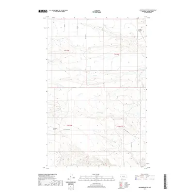
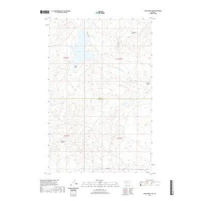
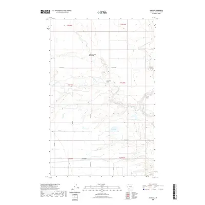
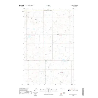
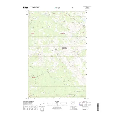
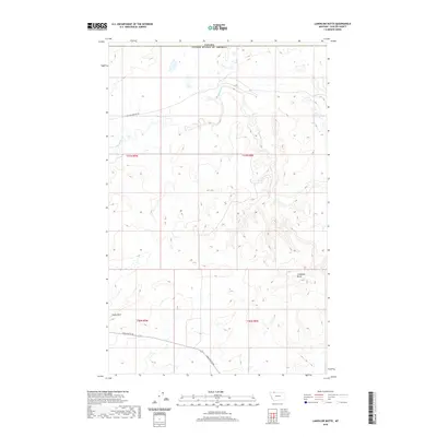
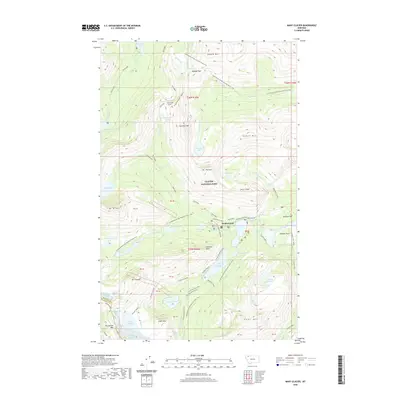
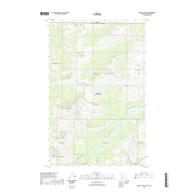
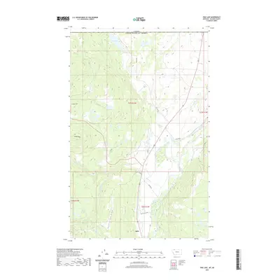
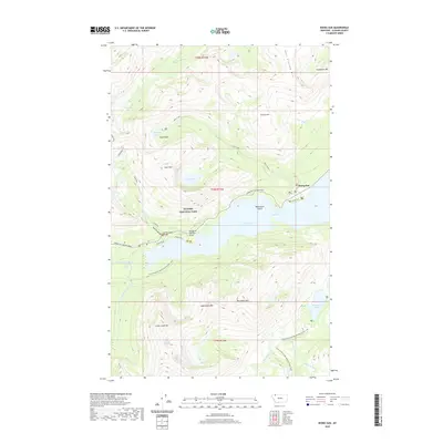
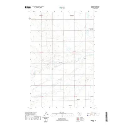
1907 Map of Blackfoot Res.
USGS Topo · Published 1907About this map
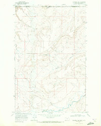
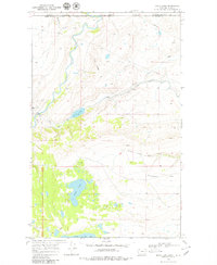
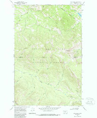
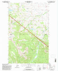
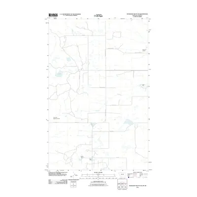
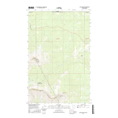
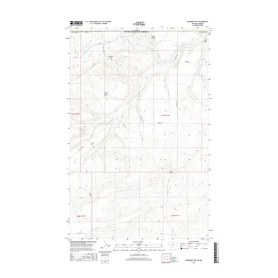
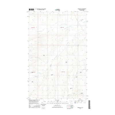
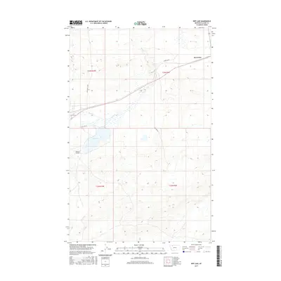
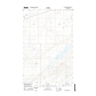
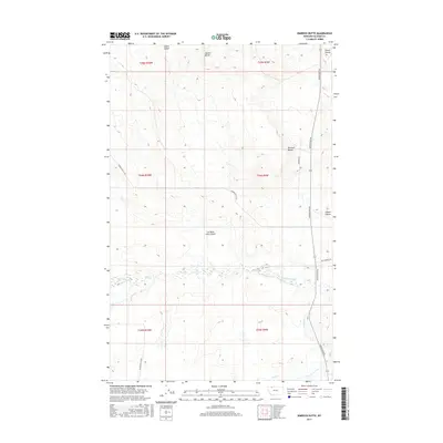
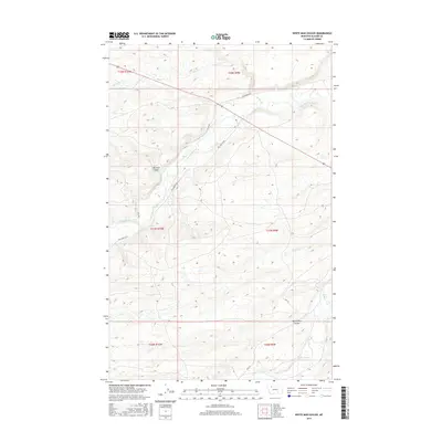
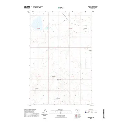
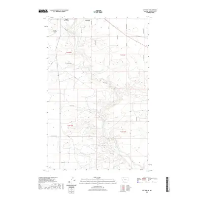
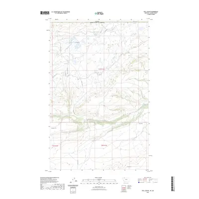
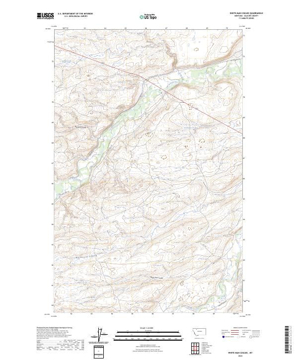
A.F. Dunnington and his team surveyed this northern Montana landscape in 1907 during a collaborative effort between the U.S. Geological Survey, the U.S. General Land Office, and the U.S. Reclamation Service. The sheet is a technical study of elevation and drainage, focusing on the sharp bluffs and river valleys found within T.34 N. and T.33 N.. Benchmarks such as BM 3775 and BM 3713 serve as primary anchors for the contour data, which was likely gathered to support early irrigation or land reclamation projects in the region. The map emphasizes the physical topography over human settlement, providing a clear record of the terrain as it existed before significant modern development altered the local water systems.
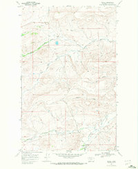
Find a feature on this map
7 named features on this map. Tap any name to fly to it.
Don’t see what you’re looking for? This feature index may not catch every label — zoom into the map to look around manually.
Map Details
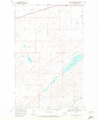
Editions of this 1907 Blackfoot Res. Map
This is the sole edition of this map. No revisions or reprints were ever made.
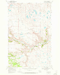
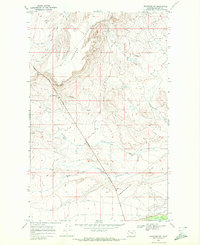
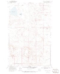
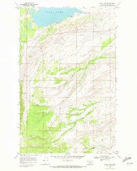
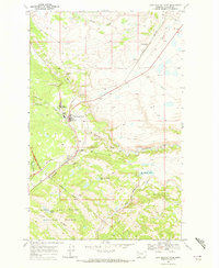
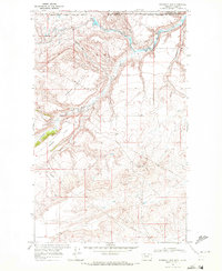
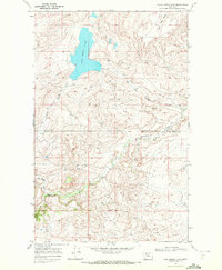
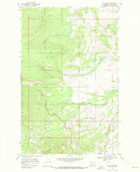
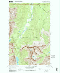
Historical Maps of Cut Bank Through Time
341 maps found

1904 Chief Mountain
Glacier County, MT
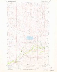
1907 Blackfoot Res.
Glacier County, MT
1938 Chief Mountain
Glacier County, MT
1966 Boru Spring
Glacier County, MT
1966 Cut Bank SE
Glacier County, MT
1966 Gunsight
Glacier County, MT
1966 Squaw Buttes
Glacier County, MT
1968 Big Rock
Glacier County, MT
1968 Browning NE
Glacier County, MT
1968 Buffalo Lake
Glacier County, MT
1968 Bushnell Hill
Glacier County, MT
1968 Chief Mountain
Glacier County, MT
1968 Cut Bank Pass
Glacier County, MT
1968 Dead Indian Spring
Glacier County, MT
1968 Del Bonita
Glacier County, MT
1968 Duck Lake
Glacier County, MT
1968 East Glacier Park
Glacier County, MT
1968 Emigrant Gap
Glacier County, MT
1968 Fort Piegan
Glacier County, MT
1968 Four Horns Lake
Glacier County, MT
1968 Fox Creek
Glacier County, MT
1968 Gable Mountain
Glacier County, MT
1968 Goose Lake
Glacier County, MT
1968 Half Dome Crag
Glacier County, MT
1968 Hall Coulee
Glacier County, MT
1968 Headlight Butte
Glacier County, MT
1968 Headlight Butte NE
Glacier County, MT
1968 Headlight Butte NW
Glacier County, MT
1968 Hoodoo Hill
Glacier County, MT
1968 Horse Lake
Glacier County, MT
1968 Hyde Creek
Glacier County, MT
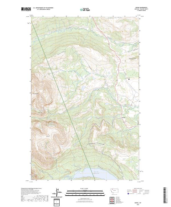
1968 Kiowa
Glacier County, MT
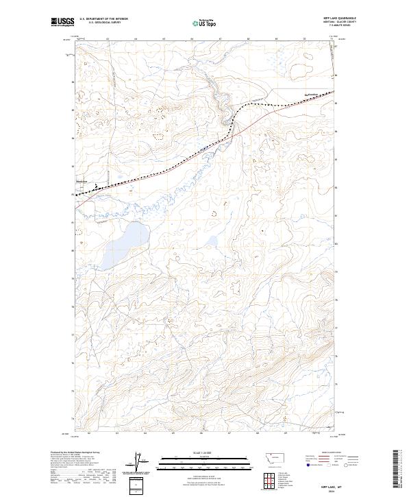
1968 Kipp Lake
Glacier County, MT
1968 Lake Sherburne
Glacier County, MT
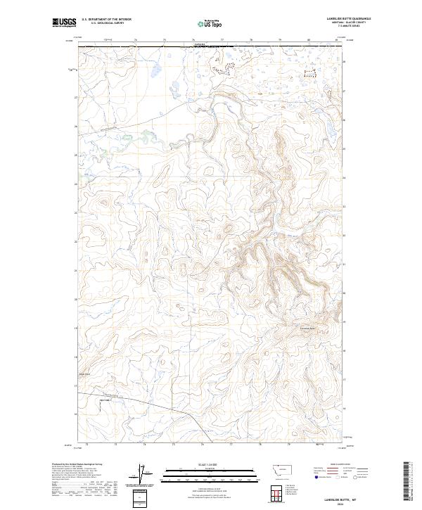
1968 Landslide Butte
Glacier County, MT
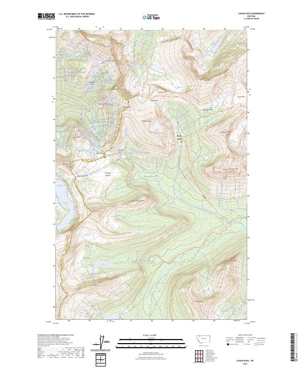
1968 Logan Pass
Glacier County, MT
1968 Love Rock
Glacier County, MT

1968 Magee Ranch
Glacier County, MT
1968 Many Glacier
Glacier County, MT
1968 Mission Lake East
Glacier County, MT
1968 Mission Lake West
Glacier County, MT
1968 Mitten Lake
Glacier County, MT
1968 Mount Cleveland
Glacier County, MT
1968 Mount Rockwell
Glacier County, MT
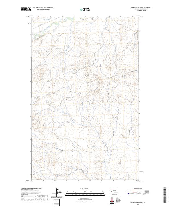
1968 Nightshoot Coulee
Glacier County, MT
1968 Piegan
Glacier County, MT
1968 Pike Lake
Glacier County, MT
1968 Porcupine Ridge
Glacier County, MT
1968 Rimrock Butte
Glacier County, MT
1968 Rimrock Ranch
Glacier County, MT
1968 Rising Sun
Glacier County, MT
1968 Rocky Buttes
Glacier County, MT
1968 Sharp Lake
Glacier County, MT
1968 Squaw Mountain
Glacier County, MT
1968 Summit
Glacier County, MT
1968 Sundance
Glacier County, MT
1968 Wetzel
Glacier County, MT
1968 White Man Coulee
Glacier County, MT
1995 East Glacier Park
Glacier County, MT
1995 Half Dome Crag
Glacier County, MT
1995 Hyde Creek
Glacier County, MT
1995 Mitten Lake
Glacier County, MT
1995 Squaw Mountain
Glacier County, MT
1995 Summit
Glacier County, MT
2011 Big Rock
Glacier County, MT
2011 Boru Spring
Glacier County, MT
2011 Browning NE
Glacier County, MT
2011 Buffalo Lake
Glacier County, MT
2011 Bushnell Hill
Glacier County, MT
2011 Chief Mountain
Glacier County, MT
2011 Cut Bank Pass
Glacier County, MT
2011 Cut Bank SE
Glacier County, MT
2011 Dancing Lady Mountain
Glacier County, MT
2011 Dead Indian Spring
Glacier County, MT
2011 Del Bonita
Glacier County, MT
2011 Duckhead Buttes
Glacier County, MT
2011 Duck Lake
Glacier County, MT
2011 East Glacier Park
Glacier County, MT
2011 Emigrant Gap
Glacier County, MT
2011 Fort Piegan
Glacier County, MT
2011 Four Horns Lake
Glacier County, MT
2011 Fox Creek
Glacier County, MT
2011 Gable Mountain
Glacier County, MT
2011 Goose Lake
Glacier County, MT
2011 Gunsight
Glacier County, MT
2011 Half Dome Crag
Glacier County, MT
2011 Hall Coulee
Glacier County, MT

2011 Headlight Butte
Glacier County, MT
2011 Headlight Butte NE
Glacier County, MT
2011 Headlight Butte NW
Glacier County, MT
2011 Hoodoo Hill
Glacier County, MT
2011 Horse Lake
Glacier County, MT
2011 Hyde Creek
Glacier County, MT
2011 Kiowa
Glacier County, MT
2011 Kipp Lake
Glacier County, MT
2011 Lake Sherburne
Glacier County, MT
2011 Landslide Butte
Glacier County, MT
2011 Logan Pass
Glacier County, MT
2011 Love Rock
Glacier County, MT
2011 Magee Ranch
Glacier County, MT
2011 Many Glacier
Glacier County, MT
2011 Mission Lake East
Glacier County, MT
2011 Mission Lake West
Glacier County, MT
2011 Mitten Lake
Glacier County, MT
2011 Mount Cleveland
Glacier County, MT
2011 Mount Rockwell
Glacier County, MT
2011 Nightshoot Coulee
Glacier County, MT
2011 Piegan
Glacier County, MT
2011 Pike Lake
Glacier County, MT
2011 Porcupine Ridge
Glacier County, MT
2011 Rimrock Butte
Glacier County, MT
2011 Rimrock Ranch
Glacier County, MT
2011 Rising Sun
Glacier County, MT
2011 Rocky Buttes
Glacier County, MT
2011 Sharp Lake
Glacier County, MT
2011 Summit
Glacier County, MT
2011 Sundance
Glacier County, MT

2011 Wetzel
Glacier County, MT
2011 White Man Coulee
Glacier County, MT
2014 Big Rock
Glacier County, MT
2014 Boru Spring
Glacier County, MT
2014 Browning NE
Glacier County, MT
2014 Buffalo Lake
Glacier County, MT
2014 Bushnell Hill
Glacier County, MT
2014 Chief Mountain
Glacier County, MT
2014 Cut Bank Pass
Glacier County, MT
2014 Cut Bank SE
Glacier County, MT
2014 Dancing Lady Mountain
Glacier County, MT
2014 Dead Indian Spring
Glacier County, MT
2014 Del Bonita
Glacier County, MT
2014 Duckhead Buttes
Glacier County, MT
2014 Duck Lake
Glacier County, MT
2014 East Glacier Park
Glacier County, MT

2014 Emigrant Gap
Glacier County, MT
2014 Fort Piegan
Glacier County, MT
2014 Four Horns Lake
Glacier County, MT
2014 Fox Creek
Glacier County, MT

2014 Gable Mountain
Glacier County, MT
2014 Goose Lake
Glacier County, MT
2014 Gunsight
Glacier County, MT
2014 Half Dome Crag
Glacier County, MT
2014 Hall Coulee
Glacier County, MT
2014 Headlight Butte
Glacier County, MT
2014 Headlight Butte NE
Glacier County, MT
2014 Headlight Butte NW
Glacier County, MT
2014 Hoodoo Hill
Glacier County, MT
2014 Horse Lake
Glacier County, MT
2014 Hyde Creek
Glacier County, MT
2014 Kiowa
Glacier County, MT
2014 Kipp Lake
Glacier County, MT
2014 Lake Sherburne
Glacier County, MT
2014 Landslide Butte
Glacier County, MT
2014 Logan Pass
Glacier County, MT
2014 Love Rock
Glacier County, MT
2014 Magee Ranch
Glacier County, MT
2014 Many Glacier
Glacier County, MT
2014 Mission Lake East
Glacier County, MT
2014 Mission Lake West
Glacier County, MT
2014 Mitten Lake
Glacier County, MT
2014 Mount Cleveland
Glacier County, MT
2014 Mount Rockwell
Glacier County, MT
2014 Nightshoot Coulee
Glacier County, MT
2014 Piegan
Glacier County, MT
2014 Pike Lake
Glacier County, MT
2014 Porcupine Ridge
Glacier County, MT
2014 Rimrock Butte
Glacier County, MT
2014 Rimrock Ranch
Glacier County, MT
2014 Rising Sun
Glacier County, MT
2014 Rocky Buttes
Glacier County, MT
2014 Sharp Lake
Glacier County, MT
2014 Summit
Glacier County, MT
2014 Sundance
Glacier County, MT
2014 Wetzel
Glacier County, MT
2014 White Man Coulee
Glacier County, MT
2017 Big Rock
Glacier County, MT
2017 Boru Spring
Glacier County, MT
2017 Browning NE
Glacier County, MT
2017 Buffalo Lake
Glacier County, MT
2017 Bushnell Hill
Glacier County, MT
2017 Chief Mountain
Glacier County, MT
2017 Cut Bank Pass
Glacier County, MT
2017 Cut Bank SE
Glacier County, MT
2017 Dancing Lady Mountain
Glacier County, MT
2017 Dead Indian Spring
Glacier County, MT
2017 Del Bonita
Glacier County, MT

2017 Duckhead Buttes
Glacier County, MT
2017 Duck Lake
Glacier County, MT
2017 East Glacier Park
Glacier County, MT
2017 Emigrant Gap
Glacier County, MT
2017 Fort Piegan
Glacier County, MT
2017 Four Horns Lake
Glacier County, MT
2017 Fox Creek
Glacier County, MT
2017 Gable Mountain
Glacier County, MT
2017 Goose Lake
Glacier County, MT
2017 Gunsight
Glacier County, MT
2017 Half Dome Crag
Glacier County, MT
2017 Hall Coulee
Glacier County, MT
2017 Headlight Butte
Glacier County, MT
2017 Headlight Butte NE
Glacier County, MT
2017 Headlight Butte NW
Glacier County, MT
2017 Hoodoo Hill
Glacier County, MT
2017 Horse Lake
Glacier County, MT
2017 Hyde Creek
Glacier County, MT
2017 Kiowa
Glacier County, MT
2017 Kipp Lake
Glacier County, MT
2017 Lake Sherburne
Glacier County, MT
2017 Landslide Butte
Glacier County, MT
2017 Logan Pass
Glacier County, MT
2017 Love Rock
Glacier County, MT
2017 Magee Ranch
Glacier County, MT
2017 Many Glacier
Glacier County, MT
2017 Mission Lake East
Glacier County, MT
2017 Mission Lake West
Glacier County, MT
2017 Mitten Lake
Glacier County, MT
2017 Mount Cleveland
Glacier County, MT
2017 Mount Rockwell
Glacier County, MT
2017 Nightshoot Coulee
Glacier County, MT
2017 Piegan
Glacier County, MT
2017 Pike Lake
Glacier County, MT
2017 Porcupine Ridge
Glacier County, MT
2017 Rimrock Butte
Glacier County, MT
2017 Rimrock Ranch
Glacier County, MT
2017 Rising Sun
Glacier County, MT
2017 Rocky Buttes
Glacier County, MT
2017 Sharp Lake
Glacier County, MT
2017 Summit
Glacier County, MT
2017 Sundance
Glacier County, MT
2017 Wetzel
Glacier County, MT
2017 White Man Coulee
Glacier County, MT
2020 Big Rock
Glacier County, MT
2020 Boru Spring
Glacier County, MT
2020 Browning NE
Glacier County, MT
2020 Buffalo Lake
Glacier County, MT
2020 Bushnell Hill
Glacier County, MT
2020 Chief Mountain
Glacier County, MT
2020 Cut Bank Pass
Glacier County, MT
2020 Cut Bank SE
Glacier County, MT
2020 Dancing Lady Mountain
Glacier County, MT
2020 Dead Indian Spring
Glacier County, MT
2020 Del Bonita
Glacier County, MT
2020 Duckhead Buttes
Glacier County, MT
2020 Duck Lake
Glacier County, MT
2020 East Glacier Park
Glacier County, MT

2020 Emigrant Gap
Glacier County, MT
2020 Fort Piegan
Glacier County, MT
2020 Four Horns Lake
Glacier County, MT
2020 Fox Creek
Glacier County, MT
2020 Gable Mountain
Glacier County, MT
2020 Goose Lake
Glacier County, MT
2020 Gunsight
Glacier County, MT
2020 Half Dome Crag
Glacier County, MT
2020 Hall Coulee
Glacier County, MT
2020 Headlight Butte
Glacier County, MT
2020 Headlight Butte NE
Glacier County, MT
2020 Headlight Butte NW
Glacier County, MT
2020 Hoodoo Hill
Glacier County, MT
2020 Horse Lake
Glacier County, MT
2020 Hyde Creek
Glacier County, MT
2020 Kiowa
Glacier County, MT
2020 Kipp Lake
Glacier County, MT
2020 Lake Sherburne
Glacier County, MT
2020 Landslide Butte
Glacier County, MT
2020 Logan Pass
Glacier County, MT
2020 Love Rock
Glacier County, MT
2020 Magee Ranch
Glacier County, MT
2020 Many Glacier
Glacier County, MT
2020 Mission Lake East
Glacier County, MT
2020 Mission Lake West
Glacier County, MT
2020 Mitten Lake
Glacier County, MT
2020 Mount Cleveland
Glacier County, MT
2020 Mount Rockwell
Glacier County, MT
2020 Nightshoot Coulee
Glacier County, MT
2020 Piegan
Glacier County, MT
2020 Pike Lake
Glacier County, MT
2020 Porcupine Ridge
Glacier County, MT
2020 Rimrock Butte
Glacier County, MT
2020 Rimrock Ranch
Glacier County, MT
2020 Rising Sun
Glacier County, MT
2020 Rocky Buttes
Glacier County, MT
2020 Sharp Lake
Glacier County, MT
2020 Summit
Glacier County, MT
2020 Sundance
Glacier County, MT
2020 Wetzel
Glacier County, MT
2020 White Man Coulee
Glacier County, MT
2023 Emigrant Gap
Glacier County, MT
2023 Hall Coulee
Glacier County, MT

2024 Big Rock
Glacier County, MT
2024 Boru Spring
Glacier County, MT
2024 Browning NE
Glacier County, MT
2024 Buffalo Lake
Glacier County, MT
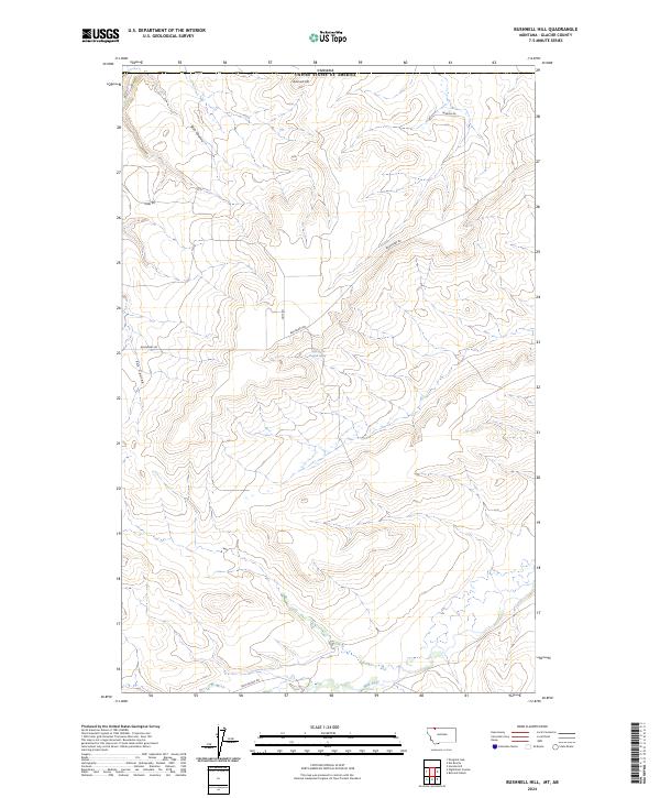
2024 Bushnell Hill
Glacier County, MT
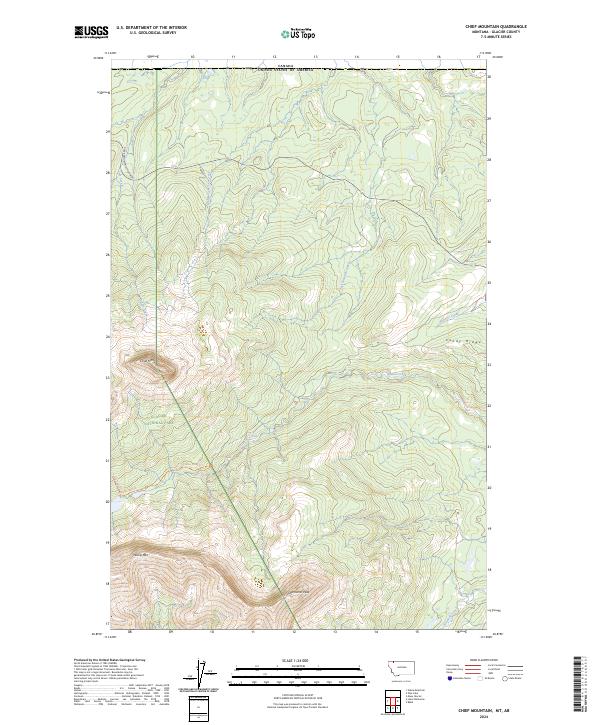
2024 Chief Mountain
Glacier County, MT
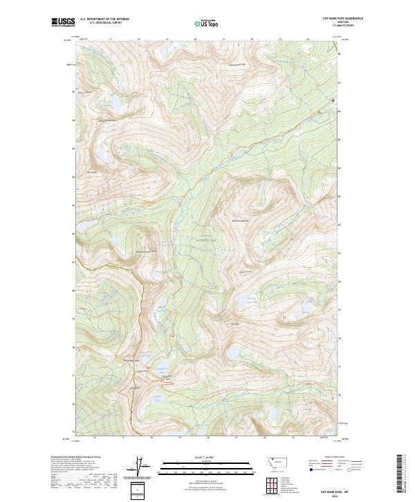
2024 Cut Bank Pass
Glacier County, MT
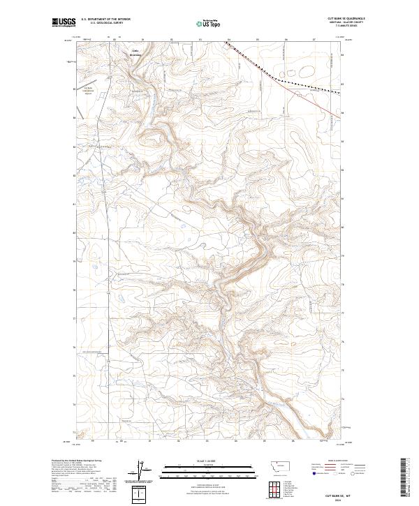
2024 Cut Bank SE
Glacier County, MT
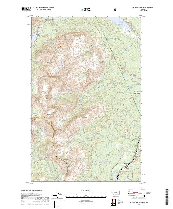
2024 Dancing Lady Mountain
Glacier County, MT
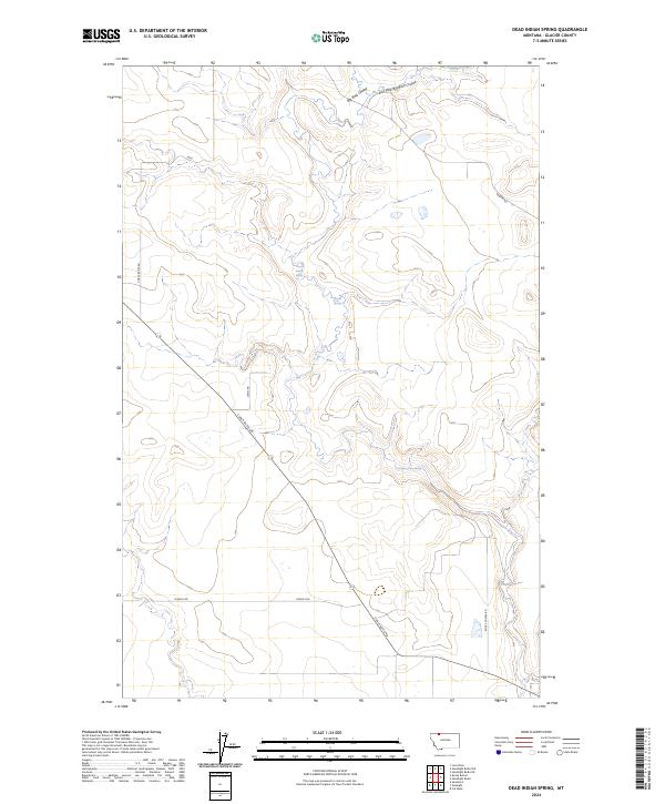
2024 Dead Indian Spring
Glacier County, MT
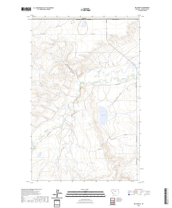
2024 Del Bonita
Glacier County, MT
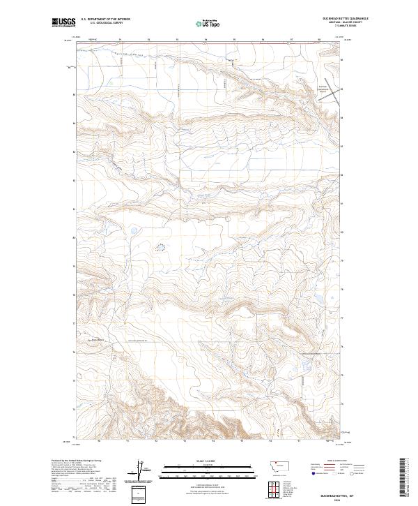
2024 Duckhead Buttes
Glacier County, MT
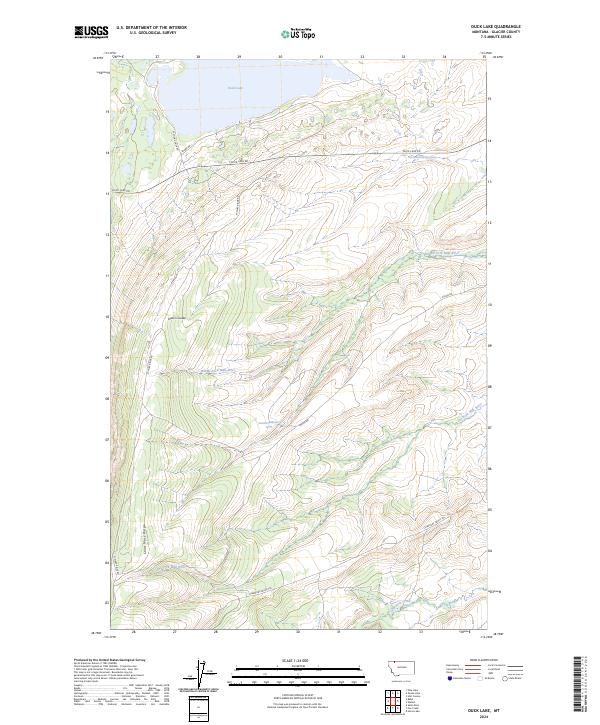
2024 Duck Lake
Glacier County, MT
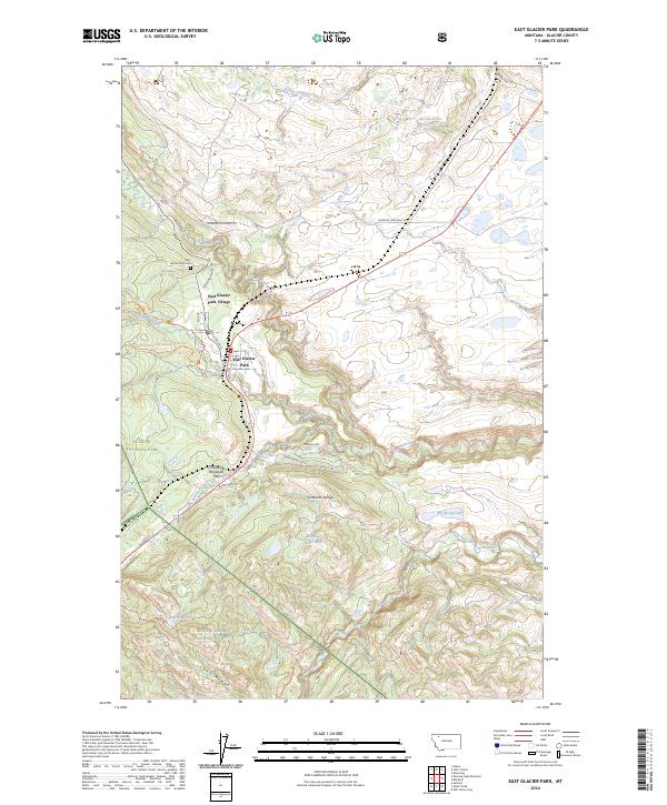
2024 East Glacier Park
Glacier County, MT
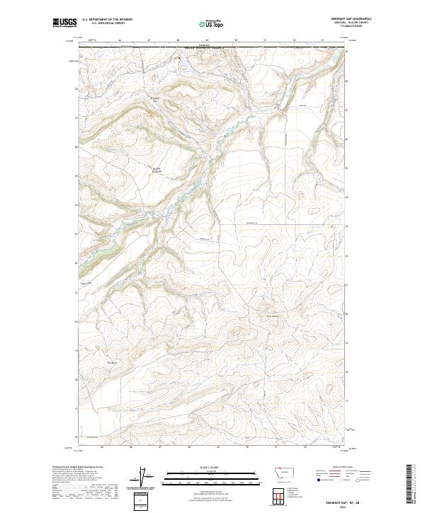
2024 Emigrant Gap
Glacier County, MT
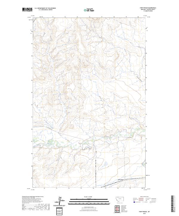
2024 Fort Piegan
Glacier County, MT
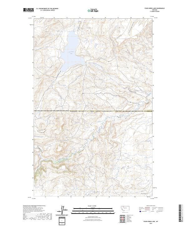
2024 Four Horns Lake
Glacier County, MT
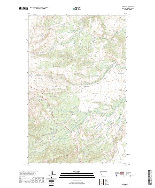
2024 Fox Creek
Glacier County, MT
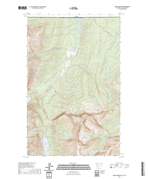
2024 Gable Mountain
Glacier County, MT
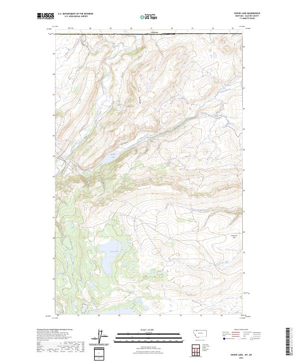
2024 Goose Lake
Glacier County, MT

2024 Gunsight
Glacier County, MT
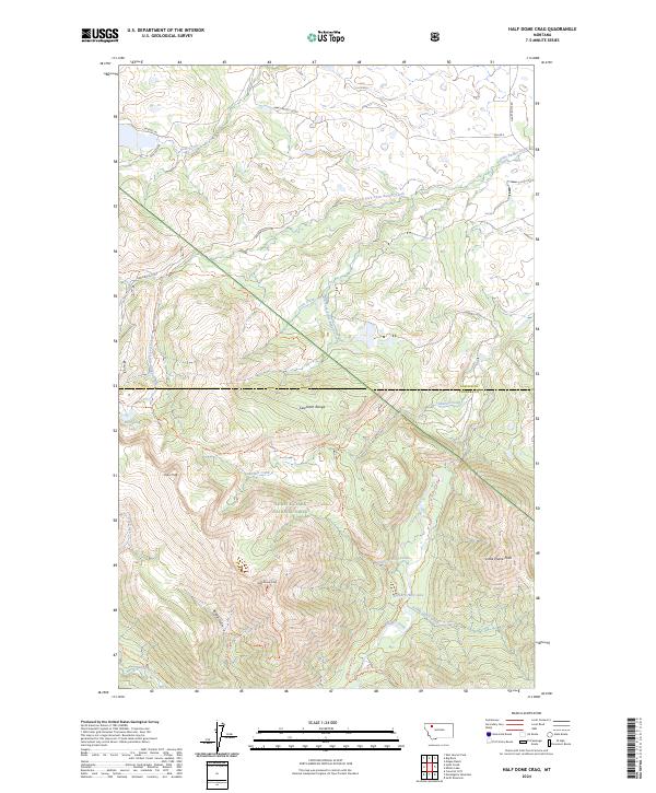
2024 Half Dome Crag
Glacier County, MT
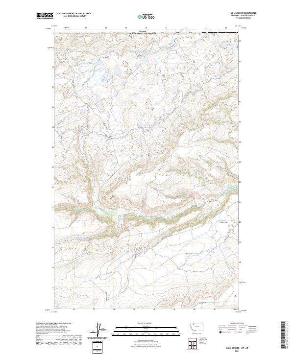
2024 Hall Coulee
Glacier County, MT
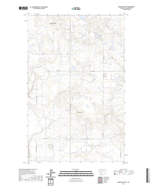
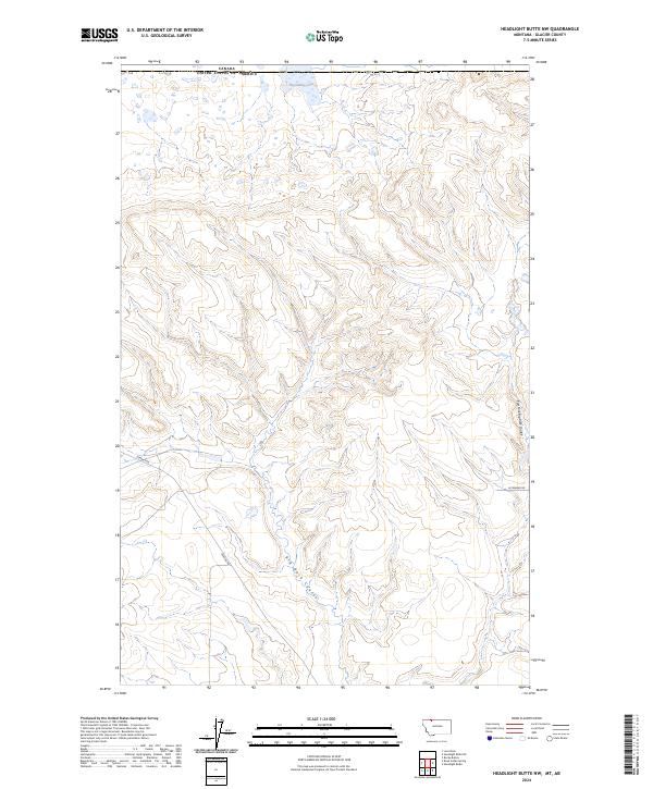
2024 Headlight Butte
Glacier County, MT
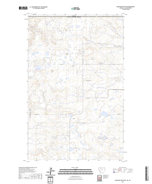
2024 Headlight Butte NE
Glacier County, MT
2024 Headlight Butte NW
Glacier County, MT
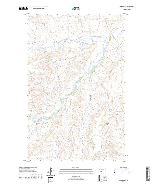
2024 Hoodoo Hill
Glacier County, MT
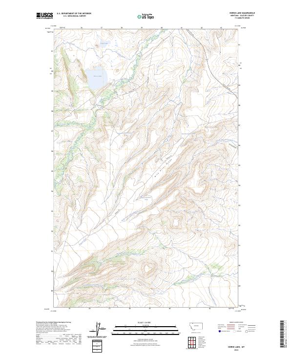
2024 Horse Lake
Glacier County, MT
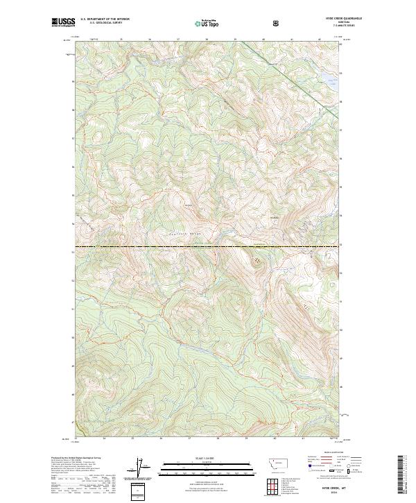
2024 Hyde Creek
Glacier County, MT
2024 Kiowa
Glacier County, MT
2024 Kipp Lake
Glacier County, MT

2024 Lake Sherburne
Glacier County, MT
2024 Landslide Butte
Glacier County, MT
2024 Logan Pass
Glacier County, MT
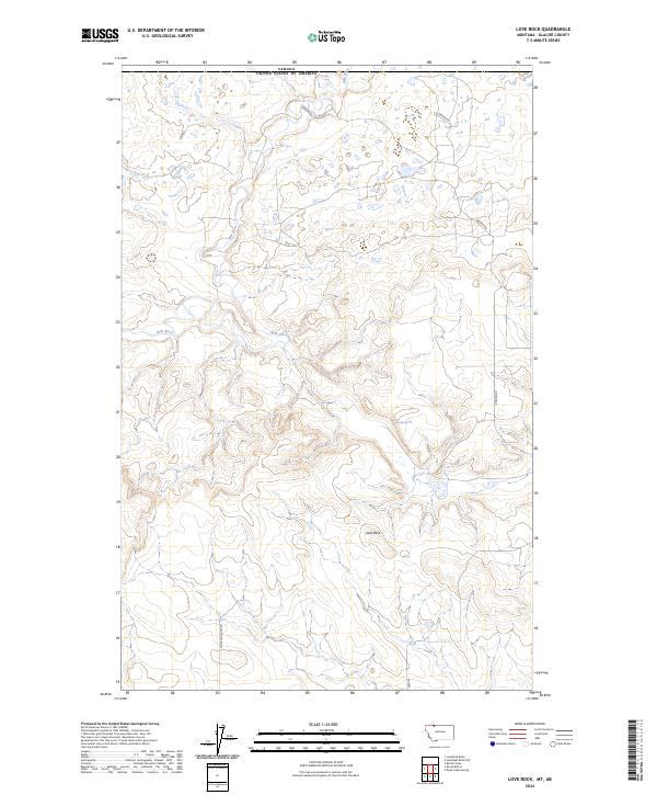
2024 Love Rock
Glacier County, MT
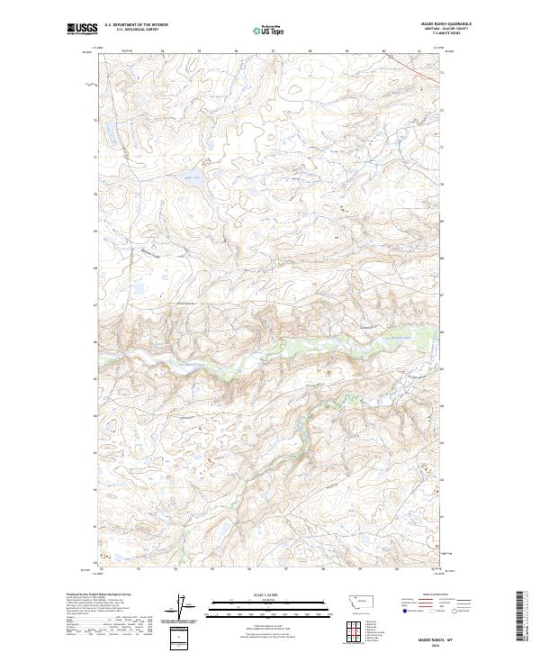
2024 Magee Ranch
Glacier County, MT
2024 Many Glacier
Glacier County, MT
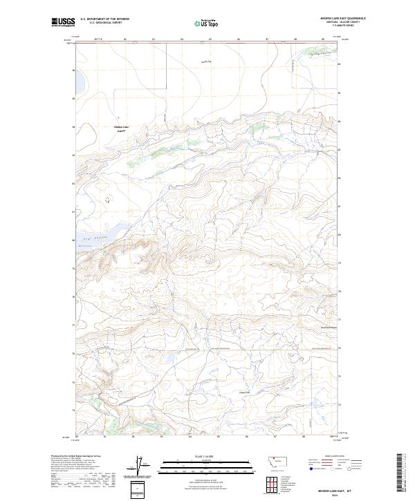
2024 Mission Lake East
Glacier County, MT
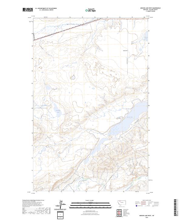
2024 Mission Lake West
Glacier County, MT
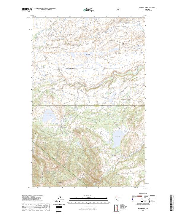
2024 Mitten Lake
Glacier County, MT
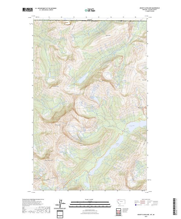
2024 Mount Cleveland
Glacier County, MT
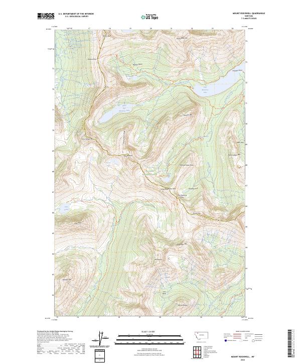
2024 Mount Rockwell
Glacier County, MT
2024 Nightshoot Coulee
Glacier County, MT
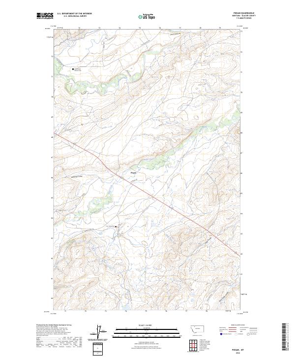
2024 Piegan
Glacier County, MT
2024 Pike Lake
Glacier County, MT
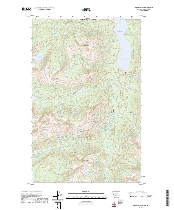
2024 Porcupine Ridge
Glacier County, MT
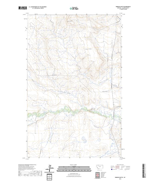
2024 Rimrock Butte
Glacier County, MT
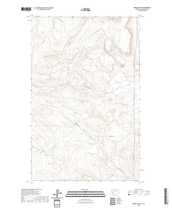
2024 Rimrock Ranch
Glacier County, MT
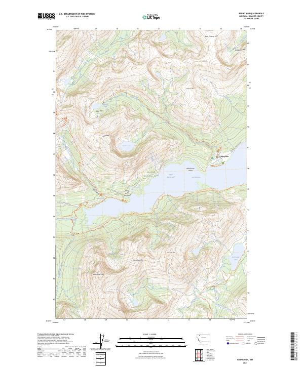
2024 Rising Sun
Glacier County, MT
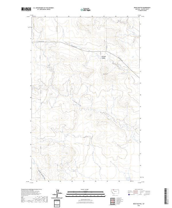
2024 Rocky Buttes
Glacier County, MT
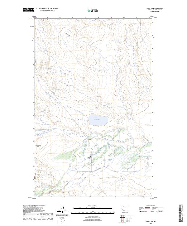
2024 Sharp Lake
Glacier County, MT
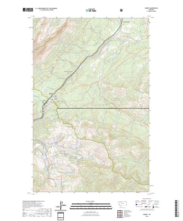
2024 Summit
Glacier County, MT
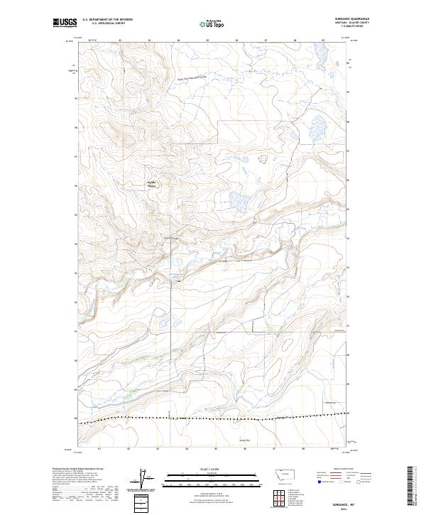
2024 Sundance
Glacier County, MT
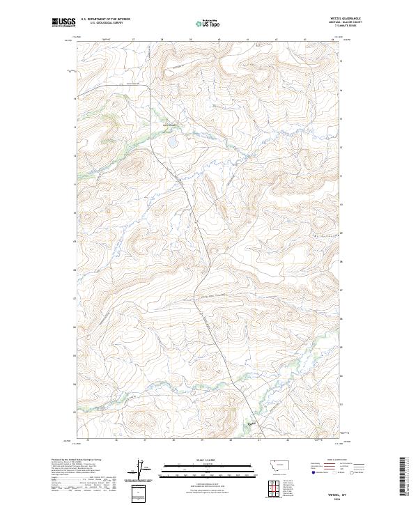
2024 Wetzel
Glacier County, MT
2024 White Man Coulee
Glacier County, MT