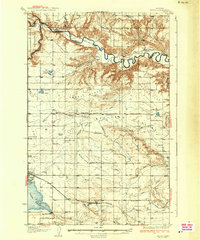
1937 Map of Valier
USGS Topo · Published 1937About this map
The town of Valier serves as the focal point of this 1930s landscape, positioned near the expansive Lake Frances and its vital Lake Frances Dam. This era of the High Plains is defined by an extensive network of Canal systems and irrigation infrastructure, which supported a growing agricultural community including the Wilkins Ranch and Stanford Russell Ranch. The Montana Western railroad cuts across the southern portion of the sheet, providing a critical transport link for the region's produce and livestock.
Find a feature on this map
46 named features on this map. Tap any name to fly to it.
Don’t see what you’re looking for? This feature index may not catch every label — zoom into the map to look around manually.
Map Details
Editions of this 1937 Valier Map
2 editions found
Other maps of this area

1907 · Blackfoot Res.
USGS Topo · 1:48,000

1909 · Cut Bank
USGS Topo · 1:125,000

1912 · Cut Bank
USGS Topo · 1:125,000

1920 · Dupuyer
USGS Topo · 1:125,000

1920 · Conrad
USGS Topo · 1:125,000

1934 · Lake Frances
USGS Topo · 1:48,000

1934 · Valier
USGS Topo · 1:62,500

1936 · Pendroy
USGS Topo · 1:48,000

1937 · Valier
USGS Topo · 1:62,500

1937 · Lake Frances
USGS Topo · 1:62,500