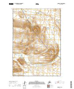
2019 Map of Naknek A-1 NE
USGS Topo · Published 2019About this map
Katmai National Park and the Becharof National Wildlife Refuge converge in this high-latitude drainage, where the landscape is defined by the flow of the King Salmon River. The terrain is marked by a network of tributaries including Granite Cr, Gertrude Cr, and Contact Cr, illustrating the complex hydrology of the Alaska Peninsula. This 2019 survey captures the wilderness character of the Lake and Peninsula Borough, showing the protected boundaries and natural watercourses before they reach the larger bays. The map serves as a contemporary record of these federal conservation lands, documenting the topographic contours and glacial-influenced drainage patterns of a region largely inaccessible by road.
Find a feature on this map
12 named features on this map. Tap any name to fly to it.
Don’t see what you’re looking for? This feature index may not catch every label — zoom into the map to look around manually.
Map Details
Editions of this 2019 Naknek A-1 NE Map
This is the sole edition of this map. No revisions or reprints were ever made.
Other maps of this area

1948 · Mt Katmai
USGS Topo · 1:250,000

1951 · Mt Katmai
USGS Topo · 1:250,000

1951 · Mount Katmai A-6
USGS Topo · 1:63,360

1951 · Mount Katmai B-6
USGS Topo · 1:63,360

1951 · Naknek B-1
USGS Topo · 1:63,360

1951 · Naknek A-1
USGS Topo · 1:63,360

1952 · Naknek
USGS Topo · 1:250,000
1953 · Mt. Katmai B-6
USGS Topo · 1:63,360

1964 · Mt. Katmai
USGS Topo · 1:250,000

1964 · Naknek
USGS Topo · 1:250,000