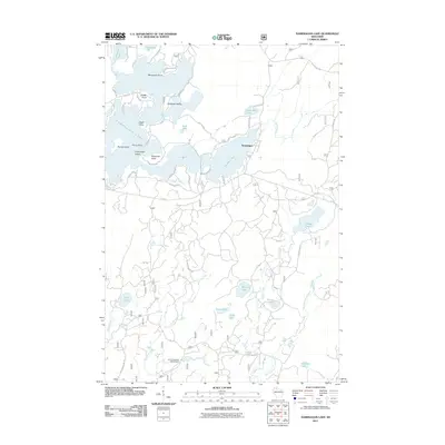
2011 Map of Namekagon Lake
USGS Topo · Published 2011About this map
Namekagon Lake and its intricate shoreline dominate this northern Wisconsin landscape, where numerous peninsulas and islands define the water's edge. This 2011 survey illustrates the complex geography of the glacial lake, featuring Anderson Island, Paines Island, and Champaign Island. The settlement of Namekagon sits near the bridge crossing to Garden Lake, serving as a central point for the local road network that includes Garmisch Resort Rd and Missionary Point Dr.
Find a feature on this map
55 named features on this map. Tap any name to fly to it.
Don’t see what you’re looking for? This feature index may not catch every label — zoom into the map to look around manually.
Map Details
Editions of this 2011 Namekagon Lake Map
This is the sole edition of this map. No revisions or reprints were ever made.
Other maps of this area

1942 · Clam Lake
USGS Topo · 1:48,000

1942 · Marengo
USGS Topo · 1:48,000

1943 · Namekagon Lake
USGS Topo · 1:48,000

1944 · Grandview
USGS Topo · 1:48,000

1945 · Namekagon Lake
USGS Topo · 1:48,000

1945 · Marengo
USGS Topo · 1:48,000

1945 · Clam Lake
USGS Topo · 1:48,000

1947 · Grandview
USGS Topo · 1:48,000

1953 · Ashland
USGS Topo · 1:250,000

1958 · Ashland
USGS Topo · 1:250,000