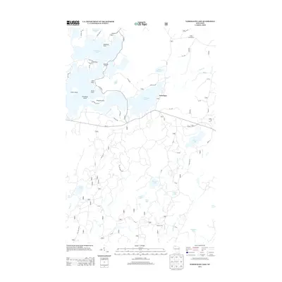
2013 Map of Namekagon Lake
USGS Topo · Published 2013About this map
Namekagon Lake serves as the centerpiece of this northern Wisconsin landscape, its irregular shoreline defined by numerous landmarks such as Missionary Point, Juneks Point, and Eagle Point. The 2013 survey illustrates the developed recreation and residential footprint around the water, including Paines Island and Champaign Island, while documenting the surrounding forest management through an extensive network of Forest Service roads like Forest Rd 328 and Forest Rd 331. The small community of Namekagon is situated near the lake's eastern shore, providing a focal point for local commerce and navigation. Beyond the primary lake, the map reveals a dense hydrologic network including Ghost Lake, Cranberry Lake, and Tank Lake, along with watercourses like Castle Cr and Ghost Cr. The presence of the Old Grade Rd in the northeast corner hints at the region's logging history and previous transportation routes.
Find a feature on this map
63 named features on this map. Tap any name to fly to it.
Don’t see what you’re looking for? This feature index may not catch every label — zoom into the map to look around manually.
Map Details
Editions of this 2013 Namekagon Lake Map
This is the sole edition of this map. No revisions or reprints were ever made.
Other maps of this area

1942 · Clam Lake
USGS Topo · 1:48,000

1942 · Marengo
USGS Topo · 1:48,000

1943 · Namekagon Lake
USGS Topo · 1:48,000

1944 · Grandview
USGS Topo · 1:48,000

1945 · Namekagon Lake
USGS Topo · 1:48,000

1945 · Marengo
USGS Topo · 1:48,000

1945 · Clam Lake
USGS Topo · 1:48,000

1947 · Grandview
USGS Topo · 1:48,000

1953 · Ashland
USGS Topo · 1:250,000

1958 · Ashland
USGS Topo · 1:250,000