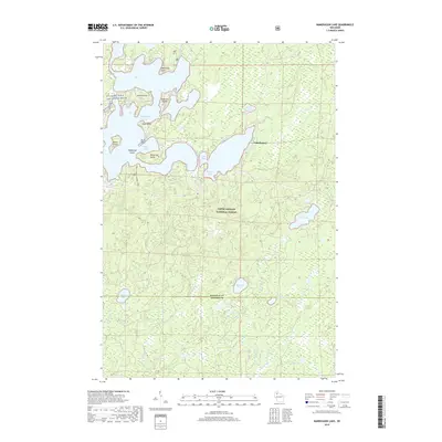
2019 Map of Namekagon Lake
USGS Topo · Published 2019About this map
Namekagon Lake dominates the northern reaches of this landscape, its intricate shoreline defined by numerous named points and islands including Missionary Point, Anderson Island, and Paines Island. The map documents a significant intersection of protected lands, where the St Croix Wild and Scenic River corridor meets the dense timberlands of the Chequamegon National Forest. This geography is shaped by water, with the larger lake giving way to a network of smaller basins such as Ghost Lake, McCloud Lake, and Evelyn Lake as one moves south toward the Bayfield and Sawyer County line.
Find a feature on this map
30 named features on this map. Tap any name to fly to it.
Don’t see what you’re looking for? This feature index may not catch every label — zoom into the map to look around manually.
Map Details
Editions of this 2019 Namekagon Lake Map
This is the sole edition of this map. No revisions or reprints were ever made.
Other maps of this area

1942 · Clam Lake
USGS Topo · 1:48,000

1942 · Marengo
USGS Topo · 1:48,000

1943 · Namekagon Lake
USGS Topo · 1:48,000

1944 · Grandview
USGS Topo · 1:48,000

1945 · Namekagon Lake
USGS Topo · 1:48,000

1945 · Marengo
USGS Topo · 1:48,000

1945 · Clam Lake
USGS Topo · 1:48,000

1947 · Grandview
USGS Topo · 1:48,000

1953 · Ashland
USGS Topo · 1:250,000

1958 · Ashland
USGS Topo · 1:250,000