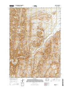
2014 Map of Namorf
USGS Topo · Published 2014About this map
Harper and Namorf anchor this high-desert landscape in Malheur County during the early 21st century. The map reveals a complex water-management system essential to the arid climate of eastern Oregon, featuring numerous catchments like Howard Cr Reservoir, Medlin Reservoir, and Lower Black Canyon Reservoir. The Malheur River flows through the central valley, closely followed by the Central Oregon Hwy and Old US 20, marking the primary transportation corridor through Harper Valley. The terrain is defined by dramatic elevation changes at Hog Creek Ridge and the deep incision of Black Canyon to the south. Springs such as Bull Spring and Tumbleweed Spring dot the landscape, indicating vital water sources for local ranching. This survey documents the intersection of natural watercourses like Chicken Cr and Squaw Cr with man-made infrastructure like the Squaw Creek Resort area and the sprawling public land survey system.
Find a feature on this map
78 named features on this map. Tap any name to fly to it.
Don’t see what you’re looking for? This feature index may not catch every label — zoom into the map to look around manually.
Map Details
Editions of this 2014 Namorf Map
This is the sole edition of this map. No revisions or reprints were ever made.
Other maps of this area

1955 · Boise
USGS Topo · 1:250,000

1958 · Boise
USGS Topo · 1:250,000

1962 · Boise
USGS Topo · 1:250,000

1966 · Harper
USGS Topo · 1:62,500

1966 · Westfall Butte
USGS Topo · 1:62,500

1972 · Tims Peak
USGS Topo · 1:24,000

1972 · Avery Creek
USGS Topo · 1:24,000
1972 · Keeney Ridge
USGS Topo · 1:24,000
1990 · South Mountain
USGS Topo · 1:24,000
1990 · Westfall
USGS Topo · 1:24,000