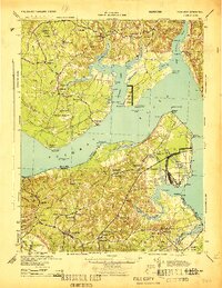
1944 Map of Nanjemoy
USGS Topo · Published 1944About this map
The Potomac River serves as the central artery for this mid-century wartime landscape, dividing the rural shores of Charles Co Maryland from King George Co Virginia. On the Maryland side, the land is marked by significant military and conservation tracts, including Doncaster State Forest and the Blossom Point Proving Ground on Taylor Neck. These government installations exist alongside long-standing community landmarks like St Ignatius Ch and several one-room schoolhouses such as Mt Hope Sch and Durham Sch.
Find a feature on this map
88 named features on this map. Tap any name to fly to it.
Don’t see what you’re looking for? This feature index may not catch every label — zoom into the map to look around manually.
Map Details
Editions of this 1944 Nanjemoy Map
This is the sole edition of this map. No revisions or reprints were ever made.
Other maps of this area

1889 · Fredericksburg
USGS Topo · 1:125,000

1890 · Mt. Vernon
USGS Topo · 1:125,000

1891 · Mt. Vernon
USGS Topo · 1:125,000

1892 · Fredericksburg
USGS Topo · 1:125,000

1892 · Brandywine
USGS Topo · 1:62,500

1892 · Montross
USGS Topo · 1:62,500

1894 · Wicomico
USGS Topo · 1:62,500

1894 · Fredericksburg
USGS Topo · 1:125,000

1894 · Mt. Vernon
USGS Topo · 1:125,000

1895 · Wicomico
USGS Topo · 1:62,500