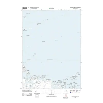
2012 Map of Nantasket Beach
USGS Topo · Published 2012About this map
Nantasket Beach and the rugged coastline of North Cohasset dominate this 2012 survey, illustrating the complex relationship between land and the Atlantic Ocean. The geography is defined by a dense archipelago of hazards and navigational aids, including the distant The Graves Light and the historic Minots Ledge Light. Inland, the map reveals established residential corridors along George Washington Blvd and Atlantic Ave, bordering natural features like Straits Pond and the Little Harbor Reservoir. The mapping of the Boston - Gloucester Ferry Crossing and the Boston - Provincetown Ferry Crossing highlights the enduring importance of maritime transit routes. From the heights of Sagamore Hill to the sands of Kenberma, the layout of coastal settlements and rocky outcroppings like Gun Rock provides a detailed view of this South Shore landscape in the early 21st century.
Find a feature on this map
110 named features on this map. Tap any name to fly to it.
Don’t see what you’re looking for? This feature index may not catch every label — zoom into the map to look around manually.
Map Details
Editions of this 2012 Nantasket Beach Map
This is the sole edition of this map. No revisions or reprints were ever made.
Other maps of this area

1885 · Abington
USGS Topo · 1:62,500

1885 · Duxbury
USGS Topo · 1:62,500

1888 · Duxbury
USGS Topo · 1:62,500

1888 · Abington
USGS Topo · 1:62,500

1892 · Boston Bay
USGS Topo · 1:62,500

1893 · Abington
USGS Topo · 1:62,500

1893 · Duxbury
USGS Topo · 1:62,500

1903 · Boston Bay
USGS Topo · 1:62,500

1918 · Duxbury
USGS Topo · 1:62,500

1920 · Abington
USGS Topo · 1:62,500