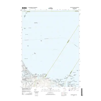
2015 Map of Nantasket Beach
USGS Topo · Published 2015About this map
Nantasket Beach and the rugged coastal edges of North Cohasset define this maritime landscape along the southern reaches of Massachusetts Bay. The terrain transitions from the densely developed peninsula near Sagamore Hill to the protected waters of Straits Pond and the Little Harbor Reservoir. Inland, the map details the residential patterns of Atlantic and Rocky Neck, while the offshore environment is marked by a complex network of navigation hazards and channels.
Find a feature on this map
103 named features on this map. Tap any name to fly to it.
Don’t see what you’re looking for? This feature index may not catch every label — zoom into the map to look around manually.
Map Details
Editions of this 2015 Nantasket Beach Map
This is the sole edition of this map. No revisions or reprints were ever made.
Other maps of this area

1885 · Abington
USGS Topo · 1:62,500

1885 · Duxbury
USGS Topo · 1:62,500

1888 · Duxbury
USGS Topo · 1:62,500

1888 · Abington
USGS Topo · 1:62,500

1892 · Boston Bay
USGS Topo · 1:62,500

1893 · Abington
USGS Topo · 1:62,500

1893 · Duxbury
USGS Topo · 1:62,500

1903 · Boston Bay
USGS Topo · 1:62,500

1918 · Duxbury
USGS Topo · 1:62,500

1920 · Abington
USGS Topo · 1:62,500