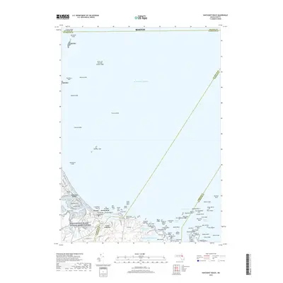
2018 Map of Nantasket Beach
USGS Topo · Published 2018About this map
Nantasket Beach and the rocky shoreline of North Cohasset dominate this coastal survey, where the Massachusetts landmass meets the Atlantic Ocean. The topography is defined by distinctive drumlins and elevations such as Sagamore Hill, Hampton Hill, and Green Hill, which rise above the surrounding wetlands and tidal inlets. Coastal residents and researchers can trace the intricate network of residential streets including Jerusalem Rd and Atlantic Ave as they wind between the coast and the inland waters of Straits Pond and Little Harbor Reservoir.
Find a feature on this map
97 named features on this map. Tap any name to fly to it.
Don’t see what you’re looking for? This feature index may not catch every label — zoom into the map to look around manually.
Map Details
Editions of this 2018 Nantasket Beach Map
This is the sole edition of this map. No revisions or reprints were ever made.
Other maps of this area

1885 · Abington
USGS Topo · 1:62,500

1885 · Duxbury
USGS Topo · 1:62,500

1888 · Duxbury
USGS Topo · 1:62,500

1888 · Abington
USGS Topo · 1:62,500

1892 · Boston Bay
USGS Topo · 1:62,500

1893 · Abington
USGS Topo · 1:62,500

1893 · Duxbury
USGS Topo · 1:62,500

1903 · Boston Bay
USGS Topo · 1:62,500

1918 · Duxbury
USGS Topo · 1:62,500

1920 · Abington
USGS Topo · 1:62,500