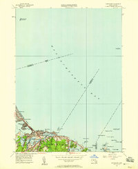
1949 Map of Nantasket
USGS Topo · Published 1958About this map
Nantasket Beach and the rugged South Shore coastline define this 1949 revision, capturing a landscape of established summer colonies and maritime navigation aids. The map details the transition from the sandy neck of Nantasket and Kenberma toward the rocky inlets of Cohasset. Residential growth is evident near North Cohasset, supported by local institutions like the Damon Sch and the Canterbury Sch.
Find a feature on this map
44 named features on this map. Tap any name to fly to it.
Don’t see what you’re looking for? This feature index may not catch every label — zoom into the map to look around manually.
Map Details
Editions of this 1949 Nantasket Map
This is the sole edition of this map. No revisions or reprints were ever made.
Other maps of this area

1885 · Abington
USGS Topo · 1:62,500

1885 · Duxbury
USGS Topo · 1:62,500

1888 · Duxbury
USGS Topo · 1:62,500

1888 · Abington
USGS Topo · 1:62,500

1892 · Boston Bay
USGS Topo · 1:62,500

1893 · Abington
USGS Topo · 1:62,500

1893 · Duxbury
USGS Topo · 1:62,500

1903 · Boston Bay
USGS Topo · 1:62,500

1918 · Duxbury
USGS Topo · 1:62,500

1920 · Abington
USGS Topo · 1:62,500