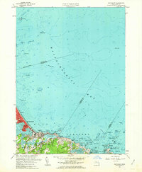
1961 Map of Nantasket
USGS Topo · Published 1963About this map
Massachusetts Bay defines the character of this coastline, where the narrow peninsula of Hull protects the southern approaches to Boston. The landscape is a transition between the rocky outcroppings of Cohasset and the sandy reaches of Nantasket Beach. Local landmarks like the historic Paragon Park and Monument Sq highlight the area's development as a premier coastal destination in the early 1960s.
Find a feature on this map
90 named features on this map. Tap any name to fly to it.
Don’t see what you’re looking for? This feature index may not catch every label — zoom into the map to look around manually.
Map Details
Editions of this 1961 Nantasket Map
2 editions found
Other maps of this area

1885 · Abington
USGS Topo · 1:62,500

1885 · Duxbury
USGS Topo · 1:62,500

1888 · Duxbury
USGS Topo · 1:62,500

1888 · Abington
USGS Topo · 1:62,500

1892 · Boston Bay
USGS Topo · 1:62,500

1893 · Abington
USGS Topo · 1:62,500

1893 · Duxbury
USGS Topo · 1:62,500

1903 · Boston Bay
USGS Topo · 1:62,500

1918 · Duxbury
USGS Topo · 1:62,500

1920 · Abington
USGS Topo · 1:62,500