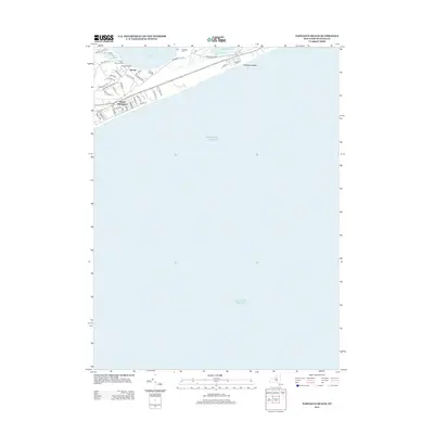
2013 Map of Napeague Beach
USGS Topo · Published 2013About this map
Napeague Beach stretches along the slender neck of land between the Atlantic Ocean and Napeague Harbor, illustrating the dense subdivision of East Hampton's waterfront in the early 21st century. The map details the transition from the secluded shores of Promised Land and Devon to the residential grid of Beach Hampton. While much of the interior shows protected wetlands and coastal terrain, the local road network is highly developed, including storied routes like Old Montauk Hwy and Cranberry Hole Rd. Local heritage is preserved in names like Abrahams Landing Rd and Shipwreck Dr, which reflect the area's long maritime and fishing history. The map captures a moment of intense coastal settlement, where narrow lanes like Marion Ln and Scrimshaw Ln provide access to the dunes and Fresh Pond.
Find a feature on this map
43 named features on this map. Tap any name to fly to it.
Don’t see what you’re looking for? This feature index may not catch every label — zoom into the map to look around manually.
Map Details
Editions of this 2013 Napeague Beach Map
This is the sole edition of this map. No revisions or reprints were ever made.
Other maps of this area

1903 · Gardiners Island
USGS Topo · 1:62,500

1904 · Easthampton
USGS Topo · 1:62,500

1904 · Gardiners Island
USGS Topo · 1:62,500

1904 · Montauk
USGS Topo · 1:62,500

1921 · Gardiners Island
USGS Topo · 1:62,500

1921 · Easthampton
USGS Topo · 1:62,500
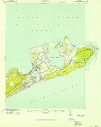
1942 · Montauk Point
USGS Topo · 1:24,000

1942 · Block Island
USGS Topo · 1:125,000

1943 · Gardiners Island East
USGS Topo · 1:24,000

1944 · Gardiners Island West
USGS Topo · 1:24,000
Featured Places
- East Hampton, NY
- Montauk, East Hampton
- Amagansett, East Hampton
- Napeague, East Hampton
- Devon, Amagansett