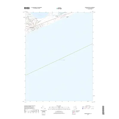
2019 Map of Napeague Beach
USGS Topo · Published 2019About this map
Beach Hampton sits at the narrowest point of the South Fork, where the coastal residential landscape is defined by the proximity of the Atlantic Ocean and Napeague Harbor. This 2019 survey captures the developed grid of coastal roads like Marine Blvd and Surf Dr contrasted against the preserved natural space of the Napeague Meadows. The settlement of Devon and the waters of Gardiners Bay occupy the northern reaches, connected to the southern beaches by a network of historic local routes and the Paumanok Path. The geography here is dominated by the low-lying wetlands and dunes that separate the hamlet of Napeague from the open sea, providing a detailed look at the modern land use and shoreline of this distinct coastal strip.
Find a feature on this map
33 named features on this map. Tap any name to fly to it.
Don’t see what you’re looking for? This feature index may not catch every label — zoom into the map to look around manually.
Map Details
Editions of this 2019 Napeague Beach Map
This is the sole edition of this map. No revisions or reprints were ever made.
Other maps of this area

1903 · Gardiners Island
USGS Topo · 1:62,500

1904 · Easthampton
USGS Topo · 1:62,500

1904 · Gardiners Island
USGS Topo · 1:62,500

1904 · Montauk
USGS Topo · 1:62,500

1921 · Gardiners Island
USGS Topo · 1:62,500

1921 · Easthampton
USGS Topo · 1:62,500
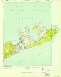
1942 · Montauk Point
USGS Topo · 1:24,000

1942 · Block Island
USGS Topo · 1:125,000

1943 · Gardiners Island East
USGS Topo · 1:24,000

1944 · Gardiners Island West
USGS Topo · 1:24,000
Featured Places
- East Hampton, NY
- Montauk, East Hampton
- Amagansett, East Hampton
- Napeague, East Hampton
- Devon, Amagansett