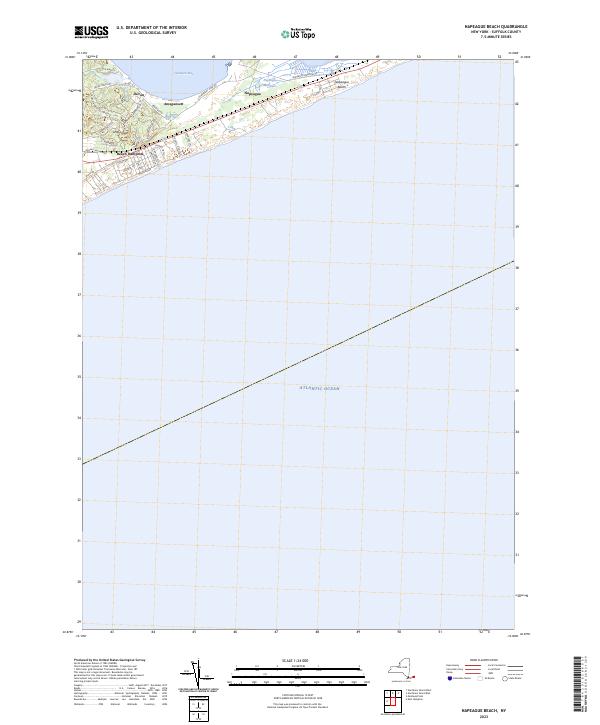
2023 Map of Napeague Beach
USGS Topo · Published 2023About this map
The coastal hamlets of Amagansett and Beach Hampton dominate the narrow stretch of land where the South Fork of Long Island tapers toward its eastern tip. This 2023 survey illustrates a landscape defined by the thin corridor of the Long Island railroad and the parallel path of the Montauk Highway, hemmed in by Gardiners Bay to the north and the Atlantic Ocean to the south. The transition from the residential grids of Devon to the more open, marshy reaches of Napeague Meadows reflects the area's ongoing balance between seasonal development and the preservation of its maritime environment.
Find a feature on this map
33 named features on this map. Tap any name to fly to it.
Don’t see what you’re looking for? This feature index may not catch every label — zoom into the map to look around manually.
Map Details
Editions of this 2023 Napeague Beach Map
This is the sole edition of this map. No revisions or reprints were ever made.
Other maps of this area

1903 · Gardiners Island
USGS Topo · 1:62,500

1904 · Easthampton
USGS Topo · 1:62,500

1904 · Gardiners Island
USGS Topo · 1:62,500

1904 · Montauk
USGS Topo · 1:62,500

1921 · Gardiners Island
USGS Topo · 1:62,500

1921 · Easthampton
USGS Topo · 1:62,500
1942 · Montauk Point
USGS Topo · 1:24,000

1942 · Block Island
USGS Topo · 1:125,000

1943 · Gardiners Island East
USGS Topo · 1:24,000

1944 · Gardiners Island West
USGS Topo · 1:24,000
Featured Places
- East Hampton, NY
- Montauk, East Hampton
- Amagansett, East Hampton
- Napeague, East Hampton
- Devon, Amagansett