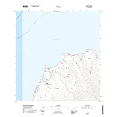
2017 Map of Napili
USGS Topo · Published 2017About this map
The coastal communities of Napili-Honokowai and Kapalua define the western shoreline of Maui, where the island's resort and residential development meets the dramatic oceanfront. This 2017 study details the network of roads and points of interest that shape local life, including Kapalua Airport and the coastal thoroughfare of Lower Honoapiilani Rd. The landscape is defined by its numerous bays and points, such as Honolua Bay, Honokahua Bay, and Flemin Beach, offering a view of the shoreline before further modern expansion.
Find a feature on this map
92 named features on this map. Tap any name to fly to it.
Don’t see what you’re looking for? This feature index may not catch every label — zoom into the map to look around manually.
Map Details
Editions of this 2017 Napili Map
This is the sole edition of this map. No revisions or reprints were ever made.
Other maps of this area

1952 · Halawa
USGS Topo · 1:24,000

1954 · Maui
USGS Topo · 1:250,000

1955 · Wailuku
USGS Topo · 1:24,000

1955 · Kahakuloa
USGS Topo · 1:24,000

1956 · Lahaina
USGS Topo · 1:24,000

1956 · Honolua
USGS Topo · 1:24,000

1966 · Maui
USGS Topo · 1:250,000

1968 · Halawa
USGS Topo · 1:24,000

1974 · Maui
USGS Topo · 1:250,000

1977 · Wailuku
USGS Topo · 1:24,000