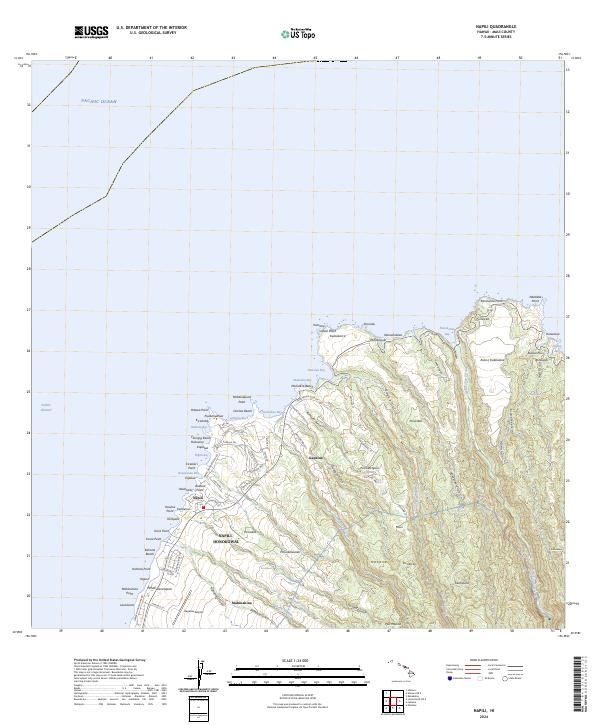
2024 Map of Napili
USGS Topo · Published 2024About this map
Kapalua Airport and the surrounding resort and residential communities of West Maui anchor this coastal survey. The landscape transitions from the developed corridors of Napili-Honokowai and Napili along Lower Honoapiilani Rd to the more open, gulch-riven terrain of the north shore. Coastal features like Fleming Beach and Honokeana Bay define the shoreline, while the interior rises toward heights such as Pu'u'unēne. The map documents a complex drainage system where Honolua Stream and Honokahua Stream carve through volcanic slopes, reaching the sea at protected inlets like Honolua Bay. This topography illustrates the intersection of modern luxury development, such as the Plantation Club Dr area, with the traditional land divisions and natural watercourses that have shaped the island's northwestern tip.
Find a feature on this map
100 named features on this map. Tap any name to fly to it.
Don’t see what you’re looking for? This feature index may not catch every label — zoom into the map to look around manually.
Map Details
Editions of this 2024 Napili Map
This is the sole edition of this map. No revisions or reprints were ever made.
Other maps of this area

1952 · Halawa
USGS Topo · 1:24,000

1954 · Maui
USGS Topo · 1:250,000

1955 · Wailuku
USGS Topo · 1:24,000

1955 · Kahakuloa
USGS Topo · 1:24,000

1956 · Lahaina
USGS Topo · 1:24,000

1956 · Honolua
USGS Topo · 1:24,000

1966 · Maui
USGS Topo · 1:250,000

1968 · Halawa
USGS Topo · 1:24,000

1974 · Maui
USGS Topo · 1:250,000

1977 · Wailuku
USGS Topo · 1:24,000