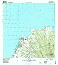
1997 Map of Napili
USGS Topo · Published 1999About this map
Honokohau and the rugged northern coastline of Maui define this late twentieth-century landscape, where the island's steep volcanic slopes meet the Pacific Ocean. The map documents a transition between the dense upland of the West Maui Forest Reserve and the developing coastal corridor. Shoreline features like Nakalele Pt and the Light Station mark the northernmost reaches, while further south, the settlements of Napili and Kahana show increasing residential and recreational density.
Find a feature on this map
65 named features on this map. Tap any name to fly to it.
Don’t see what you’re looking for? This feature index may not catch every label — zoom into the map to look around manually.
Map Details
Editions of this 1997 Napili Map
This is the sole edition of this map. No revisions or reprints were ever made.
Other maps of this area

1952 · Halawa
USGS Topo · 1:24,000

1954 · Maui
USGS Topo · 1:250,000

1955 · Wailuku
USGS Topo · 1:24,000

1955 · Kahakuloa
USGS Topo · 1:24,000

1956 · Lahaina
USGS Topo · 1:24,000

1956 · Honolua
USGS Topo · 1:24,000

1966 · Maui
USGS Topo · 1:250,000

1968 · Halawa
USGS Topo · 1:24,000

1974 · Maui
USGS Topo · 1:250,000

1977 · Wailuku
USGS Topo · 1:24,000