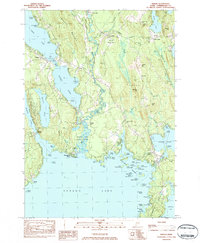
1983 Map of Naples
USGS Topo · Published 1984About this map
Songo Lock serves as a critical navigational link between Brandy Pond and Sebago Lake in this 1980s topographical study. The intricate hydrology of Cumberland County is well-documented, showing the serpentine path of the Crooked River as it feeds into the larger lake system near Sebago Lake State Park. This era of the Maine landscape is characterized by a mix of established lakeside settlements like Naples and South Casco and numerous recreational landmarks including Camp Ma-Ta-Poni and Camp Skylark.
Find a feature on this map
110 named features on this map. Tap any name to fly to it.
Don’t see what you’re looking for? This feature index may not catch every label — zoom into the map to look around manually.
Map Details
Editions of this 1983 Naples Map
3 editions found
Other maps of this area

1894 · Gray
USGS Topo · 1:62,500

1896 · Norway
USGS Topo · 1:62,500

1896 · Sebago
USGS Topo · 1:62,500

1898 · Gray
USGS Topo · 1:62,500

1908 · Poland
USGS Topo · 1:62,500

1940 · Poland
USGS Topo · 1:62,500

1942 · Poland
USGS Topo · 1:62,500

1942 · Gray
USGS Topo · 1:62,500

1942 · Sebago Lake
USGS Topo · 1:62,500

1943 · Sebago Lake
USGS Topo · 1:62,500