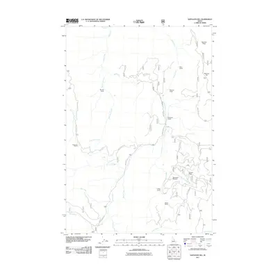
2011 Map of Napoleon Hill
USGS Topo · Published 2011About this map
Napoleon Hill and Napoleon Ridge dominate the skyline of this Lemhi County landscape, where the drainages of Moose Creek and Daly Creek carve a complex network of gulches and meadows. The map reveals a region defined by high-altitude features like Jackass Ridge and the broad opening of Racetrack Meadow. A series of Forest Service routes, such as Nat For Dev RD 020 and the Moose Crk Loop, provide access to these remote elevations. The drainage patterns of Beartrack Creek and Webfoot Creek illustrate the watershed's complexity, while named locations like Sawmill Gulch and Coffee Gulch hint at the area's historical land use and resource extraction. This 2011 survey serves as a detailed record of the road systems and topography within the Salmon-Challis National Forest area prior to more recent landscape changes.
Find a feature on this map
32 named features on this map. Tap any name to fly to it.
Don’t see what you’re looking for? This feature index may not catch every label — zoom into the map to look around manually.
Map Details
Editions of this 2011 Napoleon Hill Map
This is the sole edition of this map. No revisions or reprints were ever made.
Other maps of this area

1950 · Salmon
USGS Topo · 1:62,500

1950 · Leesburg
USGS Topo · 1:62,500

1951 · Leesburg
USGS Topo · 1:62,500

1951 · Salmon
USGS Topo · 1:62,500

1955 · Dillon
USGS Topo · 1:250,000

1956 · Elk City
USGS Topo · 1:250,000

1957 · Dillon
USGS Topo · 1:250,000

1958 · Dillon
USGS Topo · 1:250,000

1960 · Elk City
USGS Topo · 1:250,000

1960 · Ulysses Mtn
USGS Topo · 1:62,500