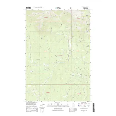
2017 Map of Napoleon Hill
USGS Topo · Published 2017About this map
Salmon National Forest dominates this section of the Salmon River Mountains in Lemhi County, where the terrain is defined by a dense network of gulches and ridges. The Salmon River cuts across the northern edge, while the interior is carved by Moose Cr and Little Moose Cr. A complex system of forest roads and trails, such as the Moose Creek Driveway and Ridge Road Napoleon, suggests a landscape managed for timber and backcountry access. Local landmarks like Napoleon Hill and Napoleon Ridge overlook a series of named drainages including Sawmill Gulch and Fan Gulch. Historically, the presence of features like Racetrack Meadow and various stock roads indicates a legacy of grazing and seasonal movement through these high-elevation valleys.
Find a feature on this map
53 named features on this map. Tap any name to fly to it.
Don’t see what you’re looking for? This feature index may not catch every label — zoom into the map to look around manually.
Map Details
Editions of this 2017 Napoleon Hill Map
This is the sole edition of this map. No revisions or reprints were ever made.
Other maps of this area

1950 · Salmon
USGS Topo · 1:62,500

1950 · Leesburg
USGS Topo · 1:62,500

1951 · Leesburg
USGS Topo · 1:62,500

1951 · Salmon
USGS Topo · 1:62,500

1955 · Dillon
USGS Topo · 1:250,000

1956 · Elk City
USGS Topo · 1:250,000

1957 · Dillon
USGS Topo · 1:250,000

1958 · Dillon
USGS Topo · 1:250,000

1960 · Elk City
USGS Topo · 1:250,000

1960 · Ulysses Mtn
USGS Topo · 1:62,500