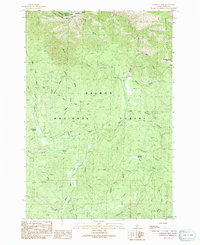
1991 Map of Napoleon Hill
USGS Topo · Published 1991About this map
The Salmon National Forest defines the rugged character of this Idaho backcountry, where the Salmon River cuts across the northern boundary. The landscape is a network of named drainages like Moose Creek, Beartrack Creek, and Napias Creek that reflect the region’s deep ties to wilderness surveying and mining. Industrial traces are evident near the center of the sheet, where a Mine Shaft and Tailings suggest the area’s history of mineral extraction.
Find a feature on this map
33 named features on this map. Tap any name to fly to it.
Don’t see what you’re looking for? This feature index may not catch every label — zoom into the map to look around manually.
Map Details
Editions of this 1991 Napoleon Hill Map
This is the sole edition of this map. No revisions or reprints were ever made.
Other maps of this area

1950 · Salmon
USGS Topo · 1:62,500

1950 · Leesburg
USGS Topo · 1:62,500

1951 · Leesburg
USGS Topo · 1:62,500

1951 · Salmon
USGS Topo · 1:62,500

1955 · Dillon
USGS Topo · 1:250,000

1956 · Elk City
USGS Topo · 1:250,000

1957 · Dillon
USGS Topo · 1:250,000

1958 · Dillon
USGS Topo · 1:250,000

1960 · Elk City
USGS Topo · 1:250,000

1960 · Ulysses Mtn
USGS Topo · 1:62,500