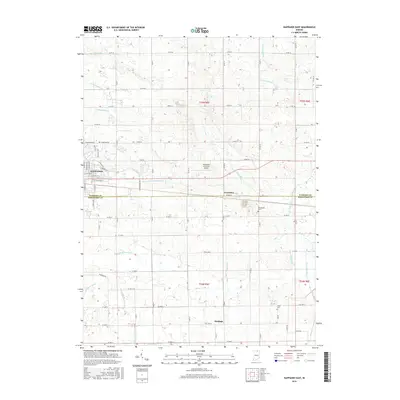
2016 Map of Nappanee East
USGS Topo · Published 2016About this map
The agricultural landscape along the Elkhart Co Kosciusko Co line is defined by an intricate network of drainage systems essential to Northern Indiana farming. Waterways such as Berlin Court Grand Ditch, Omar Neff Ditch, and Fisher-Gordon Ditch crisscross the terrain, showing how early 21st-century land management maintains the region's productivity. While the eastern edge of Nappanee anchors the northwest corner of this sheet, smaller rural communities like Gravelton and Hastings provide focal points for local history. Genealogists will find the locations of Brumbaugh Cem and Island Cem valuable for tracing family roots in the area. The presence of the Nappanee Municipal Airport and a strictly rectilinear grid of county roads, including Co RD 50 and W 1250 N, illustrates the intersection of modern infrastructure with traditional midwestern agrarian life.
Find a feature on this map
50 named features on this map. Tap any name to fly to it.
Don’t see what you’re looking for? This feature index may not catch every label — zoom into the map to look around manually.
Map Details
Editions of this 2016 Nappanee East Map
This is the sole edition of this map. No revisions or reprints were ever made.
Other maps of this area

1950 · Leesburg
USGS Topo · 1:24,000

1951 · Milford
USGS Topo · 1:24,000

1953 · Fort Wayne
USGS Topo · 1:250,000

1953 · Chicago
USGS Topo · 1:250,000

1956 · Fort Wayne
USGS Topo · 1:250,000

1957 · Chicago
USGS Topo · 1:250,000

1958 · Nappanee West
USGS Topo · 1:24,000

1958 · Nappanee East
USGS Topo · 1:24,000

1958 · Bourbon
USGS Topo · 1:24,000

1959 · Atwood
USGS Topo · 1:24,000