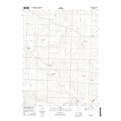
2015 Map of Napton
USGS Topo · Published 2015About this map
Napton and Wilton Springs occupy the heart of this Saline County landscape, where the northern plains meet the meandering valley of the Blackwater River. The terrain is defined by a dense network of seasonal and perennial waterways, including Salt Fork, Brush Cr, and Dicks Br, which carve into the agricultural plateaus. For those tracing regional history, the presence of Salt Branch Springs recalls the era of mineral springs and early settlement resource hubs. The southern portion of the map transitions into the Saline Co Cooper Co border near the town of Nelson, illustrating the rural road network and township divisions like t49n r20w. Family history researchers can find specific landmarks such as Sappington Cemetery and Marshall Cemetery, which remain anchored in a landscape of section lines and named trails like Mallard Trl and 184th Trl.
Find a feature on this map
56 named features on this map. Tap any name to fly to it.
Don’t see what you’re looking for? This feature index may not catch every label — zoom into the map to look around manually.
Map Details
Editions of this 2015 Napton Map
This is the sole edition of this map. No revisions or reprints were ever made.
Other maps of this area

1887 · Sedalia
USGS Topo · 1:125,000

1888 · Boonville
USGS Topo · 1:125,000

1890 · Glasgow
USGS Topo · 1:125,000

1890 · Marshall
USGS Topo · 1:125,000

1892 · Marshall
USGS Topo · 1:125,000

1894 · Sedalia
USGS Topo · 1:125,000

1901 · Marshall
USGS Topo · 1:125,000

1940 · Marshall
USGS Topo · 1:62,500

1944 · Marshall
USGS Topo · 1:62,500

1947 · Glasgow
USGS Topo · 1:62,500