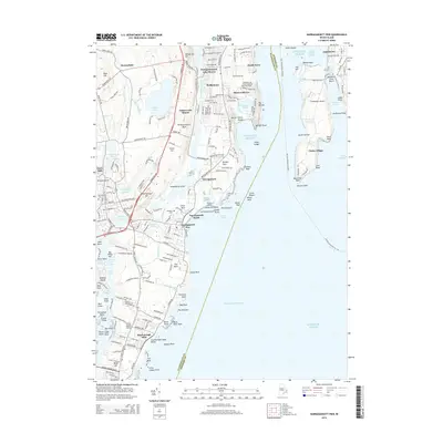
2015 Map of Narragansett Pier
USGS Topo · Published 2015About this map
Narragansett Pier and the surrounding coastline of Rhode Island reflect a landscape deeply shaped by the Atlantic. From the residential developments at Bonnet Shores and Bridgetown to the coastal recreation at Scarborough State Beach, the area is defined by its proximity to the East Passage and the Pettaquamscutt River. The interior geography features significant elevations such as Tower Hill and Meetinghouse Hill, which provided strategic views over the western shore of the Narragansett bay. Local history is anchored by sites like the Riverside Cem and Robinson Cem, while the rugged coastal geology is evidenced by named landmarks like Pettaquamscutt Rock and the lighthouse-guarded points of Conanicut Island. The map documents a sophisticated network of local roads, including the Galilee Escape Route, alongside the quiet inlets of Long Cove and Boiling Lot Cove.
Find a feature on this map
184 named features on this map. Tap any name to fly to it.
Don’t see what you’re looking for? This feature index may not catch every label — zoom into the map to look around manually.
Map Details
Editions of this 2015 Narragansett Pier Map
This is the sole edition of this map. No revisions or reprints were ever made.
Other maps of this area

1889 · Charlestown
USGS Topo · 1:62,500

1889 · Newport
USGS Topo · 1:62,500

1890 · Narragansett Bay
USGS Topo · 1:62,500

1890 · Kent
USGS Topo · 1:62,500

1892 · Narragansett Bay
USGS Topo · 1:62,500

1894 · Kent
USGS Topo · 1:62,500

1894 · Newport
USGS Topo · 1:62,500

1904 · Newport
USGS Topo · 1:62,500

1919 · Charlestown
USGS Topo · 1:62,500

1919 · Narragansett Bay
USGS Topo · 1:62,500