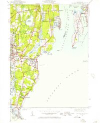
1942 Map of Narragansett Pier
USGS Topo · Published 1957About this map
Narragansett Pier and the coastal defenses of Rhode Island appear here in 1942, reflecting a shoreline defined by both summer recreation and wartime vigilance. The map details the developed waterfront between Bonnet Shores and Point Judith, featuring prominent coastal installations like Fort Phillip Kearney and Fort Nathaniel Green. Inland, the settlements of Wakefield and Peace Dale show a dense network of streets and buildings near the Saugatuckett River, while the rural stretches are marked by family-named landmarks like McSparran Hill and Rose Hill.
Find a feature on this map
89 named features on this map. Tap any name to fly to it.
Don’t see what you’re looking for? This feature index may not catch every label — zoom into the map to look around manually.
Map Details
Editions of this 1942 Narragansett Pier Map
This is the sole edition of this map. No revisions or reprints were ever made.
Other maps of this area

1889 · Charlestown
USGS Topo · 1:62,500

1889 · Newport
USGS Topo · 1:62,500

1890 · Narragansett Bay
USGS Topo · 1:62,500

1890 · Kent
USGS Topo · 1:62,500

1892 · Narragansett Bay
USGS Topo · 1:62,500

1894 · Kent
USGS Topo · 1:62,500

1894 · Newport
USGS Topo · 1:62,500

1904 · Newport
USGS Topo · 1:62,500

1919 · Charlestown
USGS Topo · 1:62,500

1919 · Narragansett Bay
USGS Topo · 1:62,500