1948 Map of Nashua
USGS Topo · Published 1956About this map
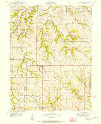
The settlement of Nashua sits at a crossroads in the hills north of Kansas City, serving as a focal point for the surrounding rural townships of Carroll, May, Platte, and Gallatin just after the war. This landscape is defined by a dense network of one-room schoolhouses that once anchored the community, including Martin School, Woods School, Gordon School, Mitchell School, Lone Star School, and Bell School. The map reveals the intricate drainage of the region, where Polecat Creek and Second Creek carve through the terrain, and Mt Olivet Church stands as a spiritual landmark for local farmstead families. A fascinating archival detail is the marking of the Old State Boundary and the line between Platte and Clay counties, providing a clear look at how historical property lines and political jurisdictions were defined in the late 1940s.
Find a feature on this map
24 named features on this map. Tap any name to fly to it.
Don’t see what you’re looking for? This feature index may not catch every label — zoom into the map to look around manually.
Map Details
Editions of this 1948 Nashua Map
This is the sole edition of this map. No revisions or reprints were ever made.
Other maps of this area

1890 · Kansas City
USGS Topo · 1:125,000

1894 · Kansas City
USGS Topo · 1:125,000

1894 · Independence
USGS Topo · 1:125,000

1914 · Smithville
USGS Topo · 1:62,500

1935 · North Kansas City
USGS Topo · 1:24,000

1935 · Liberty
USGS Topo · 1:24,000

1936 · Kearney
USGS Topo · 1:48,000

1940 · Liberty
USGS Topo · 1:31,680

1940 · North Kansas City
USGS Topo · 1:31,680

1942 · Kearney
USGS Topo · 1:62,500