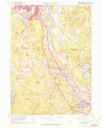
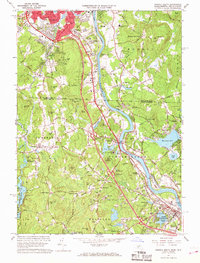
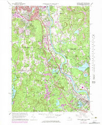
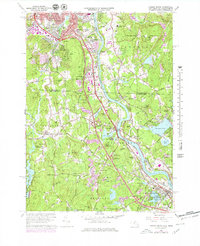
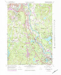
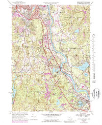
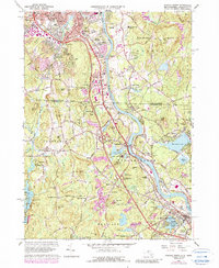
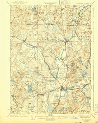
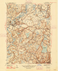
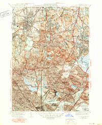
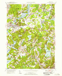
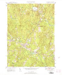
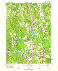
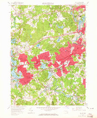
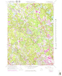
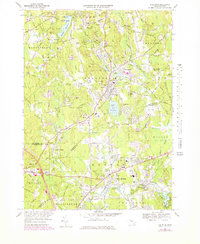
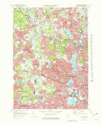
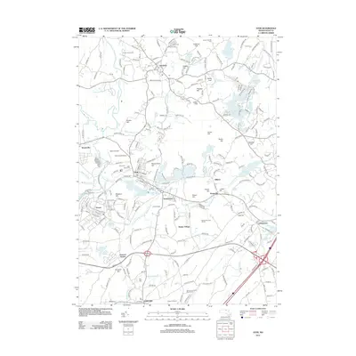
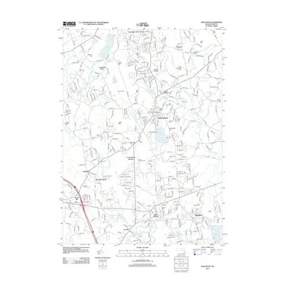
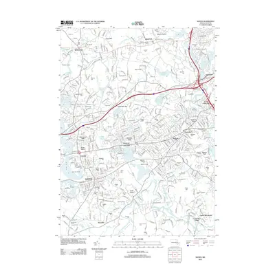
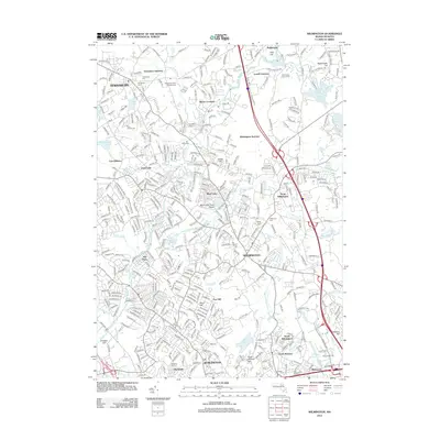
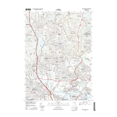
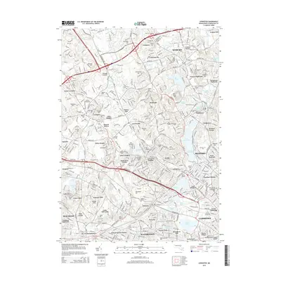
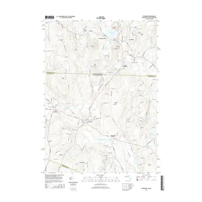
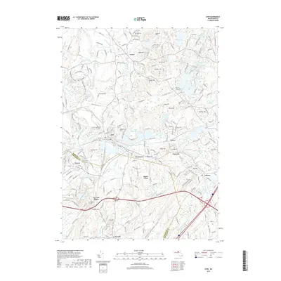
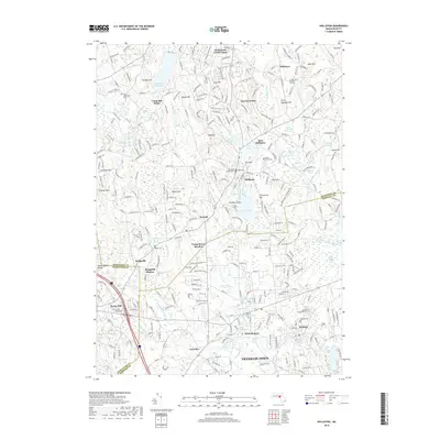
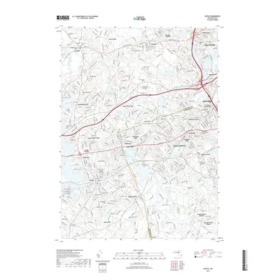
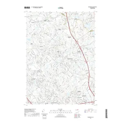
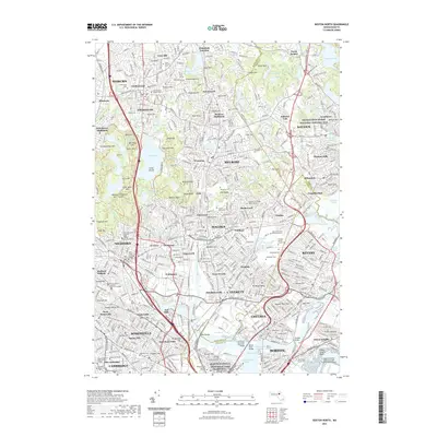
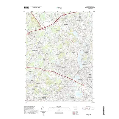
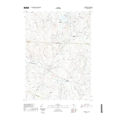
1965 Map of Nashua South
USGS Topo · Published 1972About this map
The Merrimack River carves a deep valley through this borderland, where the suburban growth of Nashua and Hudson meets the rural reaches of Dunstable and Tyngsborough. By the mid-1960s, the Everett Turnpike had already transformed the landscape with multiple interchanges, including Interchange 5 and Interchange 4, facilitating rapid expansion south of the New Hampshire line. Despite this modernization, the industrial and educational foundations of the region remain prominent, visible in the sprawling grounds of Rivier College and the Boston and Maine RR corridors.
Find a feature on this map
108 named features on this map. Tap any name to fly to it.
Don’t see what you’re looking for? This feature index may not catch every label — zoom into the map to look around manually.
Map Details
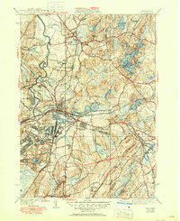
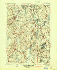
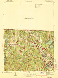
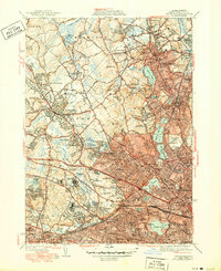
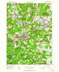
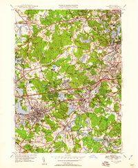
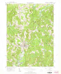
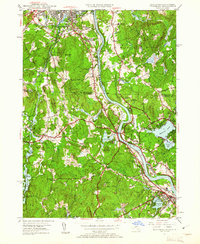
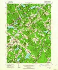
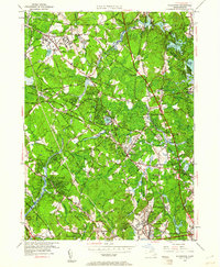
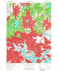
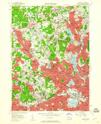
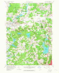
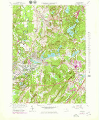
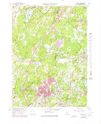
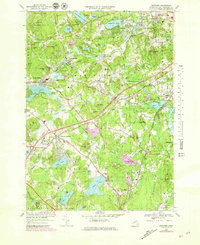
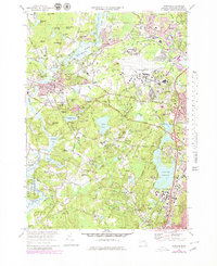
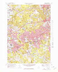
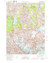
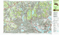
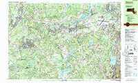
Editions of this 1965 Nashua South Map
7 editions found
Historical Maps of Lowell Through Time
147 maps found
1893 Groton
Middlesex County, MA

1931 Groton
Middlesex County, MA

1935 Ayer
Middlesex County, MA

1935 Groton
Middlesex County, MA
1936 Groton
Middlesex County, MA
1939 Ayer
Middlesex County, MA

1940 Tyngsoboro
Middlesex County, MA

1940 Westford
Middlesex County, MA
1941 Billerica
Middlesex County, MA

1941 Holliston
Middlesex County, MA
1941 Tyngsboro
Middlesex County, MA

1941 Westford
Middlesex County, MA

1942 Billerica
Middlesex County, MA

1942 Holliston
Middlesex County, MA

1942 Tyngsboro
Middlesex County, MA

1943 Boston North
Middlesex County, MA
1943 Concord
Middlesex County, MA
1943 Hudson
Middlesex County, MA

1943 Maynard
Middlesex County, MA
1943 Natick
Middlesex County, MA

1944 Lexington
Middlesex County, MA

1944 Pepperell
Middlesex County, MA
1944 Townsend
Middlesex County, MA

1944 Wilmington
Middlesex County, MA

1946 Ashby
Middlesex County, MA
1946 Boston North
Middlesex County, MA
1946 Lexington
Middlesex County, MA

1946 Tyngsboro
Middlesex County, MA
1946 Westford
Middlesex County, MA

1949 Boston North
Middlesex County, MA

1950 Ashby
Middlesex County, MA

1950 Ayer
Middlesex County, MA
1950 Billerica
Middlesex County, MA
1950 Concord
Middlesex County, MA

1950 Hudson
Middlesex County, MA
1950 Maynard
Middlesex County, MA
1950 Natick
Middlesex County, MA
1950 Pepperell
Middlesex County, MA
1950 Townsend
Middlesex County, MA
1950 Tyngsboro
Middlesex County, MA
1950 Westford
Middlesex County, MA
1950 Wilmington
Middlesex County, MA
1953 Holliston
Middlesex County, MA
1956 Boston North
Middlesex County, MA
1956 Lexington
Middlesex County, MA
1958 Concord
Middlesex County, MA
1958 Natick
Middlesex County, MA

1965 Ashby
Middlesex County, MA
1965 Billerica
Middlesex County, MA
1965 Maynard
Middlesex County, MA
1965 Pepperell
Middlesex County, MA

1965 Townsend
Middlesex County, MA
1965 Wilmington
Middlesex County, MA
1966 Ayer
Middlesex County, MA
1966 Hudson
Middlesex County, MA
1966 Westford
Middlesex County, MA
1969 Holliston
Middlesex County, MA
1970 Concord
Middlesex County, MA
1970 Natick
Middlesex County, MA
1971 Boston North
Middlesex County, MA
1971 Lexington
Middlesex County, MA

1975 Townsend
Middlesex County, MA

1977 Boston North
Middlesex County, MA

1977 Concord
Middlesex County, MA

1977 Holliston
Middlesex County, MA

1977 Hudson
Middlesex County, MA

1977 Lexington
Middlesex County, MA

1977 Maynard
Middlesex County, MA

1977 Natick
Middlesex County, MA

1977 Wilmington
Middlesex County, MA
1985 Boston North
Middlesex County, MA

1987 Billerica
Middlesex County, MA
1987 Maynard
Middlesex County, MA

1987 Reading
Middlesex County, MA

1988 Ayer
Middlesex County, MA

1988 Townsend
Middlesex County, MA
2012 Ashby
Middlesex County, MA
2012 Ayer
Middlesex County, MA
2012 Billerica
Middlesex County, MA
2012 Boston North
Middlesex County, MA
2012 Concord
Middlesex County, MA
2012 Holliston
Middlesex County, MA
2012 Hudson
Middlesex County, MA
2012 Lexington
Middlesex County, MA
2012 Maynard
Middlesex County, MA
2012 Natick
Middlesex County, MA
2012 Pepperell
Middlesex County, MA
2012 Townsend
Middlesex County, MA
2012 Westford
Middlesex County, MA
2012 Wilmington
Middlesex County, MA
2015 Ashby
Middlesex County, MA
2015 Ayer
Middlesex County, MA
2015 Billerica
Middlesex County, MA
2015 Boston North
Middlesex County, MA
2015 Concord
Middlesex County, MA
2015 Holliston
Middlesex County, MA
2015 Hudson
Middlesex County, MA
2015 Lexington
Middlesex County, MA
2015 Maynard
Middlesex County, MA
2015 Natick
Middlesex County, MA
2015 Pepperell
Middlesex County, MA
2015 Townsend
Middlesex County, MA
2015 Westford
Middlesex County, MA
2015 Wilmington
Middlesex County, MA
2018 Ashby
Middlesex County, MA
2018 Ayer
Middlesex County, MA
2018 Billerica
Middlesex County, MA
2018 Boston North
Middlesex County, MA
2018 Concord
Middlesex County, MA
2018 Holliston
Middlesex County, MA
2018 Hudson
Middlesex County, MA
2018 Lexington
Middlesex County, MA
2018 Maynard
Middlesex County, MA
2018 Natick
Middlesex County, MA
2018 Pepperell
Middlesex County, MA
2018 Townsend
Middlesex County, MA
2018 Westford
Middlesex County, MA
2018 Wilmington
Middlesex County, MA
2021 Ashby
Middlesex County, MA
2021 Ayer
Middlesex County, MA
2021 Billerica
Middlesex County, MA
2021 Boston North
Middlesex County, MA
2021 Concord
Middlesex County, MA
2021 Holliston
Middlesex County, MA
2021 Hudson
Middlesex County, MA
2021 Lexington
Middlesex County, MA
2021 Maynard
Middlesex County, MA
2021 Natick
Middlesex County, MA
2021 Pepperell
Middlesex County, MA
2021 Townsend
Middlesex County, MA
2021 Westford
Middlesex County, MA
2021 Wilmington
Middlesex County, MA
2023 Concord
Middlesex County, MA

2024 Ashby
Middlesex County, MA
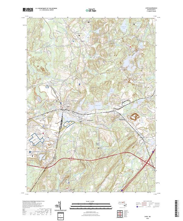
2024 Ayer
Middlesex County, MA

2024 Billerica
Middlesex County, MA

2024 Boston North
Middlesex County, MA

2024 Concord
Middlesex County, MA
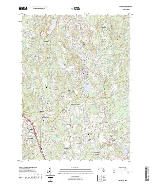
2024 Holliston
Middlesex County, MA

2024 Hudson
Middlesex County, MA

2024 Lexington
Middlesex County, MA

2024 Maynard
Middlesex County, MA
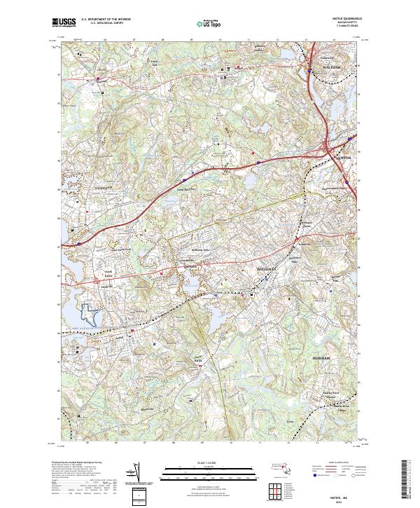
2024 Natick
Middlesex County, MA
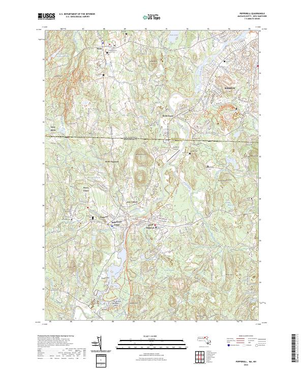
2024 Pepperell
Middlesex County, MA

2024 Townsend
Middlesex County, MA

2024 Westford
Middlesex County, MA

2024 Wilmington
Middlesex County, MA