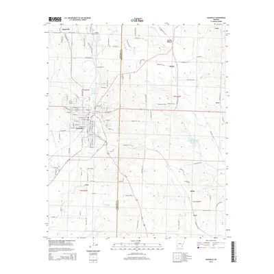
2014 Map of Nashville
USGS Topo · Published 2014About this map
Nashville serves as the primary hub of this Arkansas landscape, characterized by its dense residential grid and industrial infrastructure. The settlement is flanked by Lake Nickels and the winding course of Mine Creek, which bisects the town. Beyond the urban center, the terrain is defined by a network of rural communities such as Chapel Hill, Tokio, and Bingen. The Howard County Airport is situated north of town, reflecting the area's mid-century modernization, while the Nashville Cemetery and Cummings Cemetery near Bellair offer clear reference points for those tracing local lineages. The hydrology is dominated by the North Fork Ozan Creek Watershed Site Reservoir and several smaller tributaries like Brushy Creek and Cary Creek, which drain the undulating countryside across the Howard and Hempstead county lines.
Find a feature on this map
119 named features on this map. Tap any name to fly to it.
Don’t see what you’re looking for? This feature index may not catch every label — zoom into the map to look around manually.
Map Details
Editions of this 2014 Nashville Map
This is the sole edition of this map. No revisions or reprints were ever made.
Other maps of this area

1906 · Caddo Gap
USGS Topo · 1:125,000

1951 · Mineral Springs South
USGS Topo · 1:24,000

1951 · Columbus
USGS Topo · 1:24,000

1951 · Mineral Springs North
USGS Topo · 1:24,000

1951 · Nashville
USGS Topo · 1:24,000

1951 · Washington
USGS Topo · 1:24,000

1951 · McCaskill
USGS Topo · 1:24,000

1953 · El Dorado
USGS Topo · 1:250,000

1955 · Little Rock
USGS Topo · 1:250,000

1956 · Little Rock
USGS Topo · 1:250,000