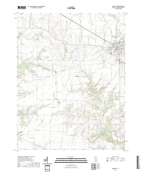
2024 Map of Nashville
USGS Topo · Published 2024About this map
Nashville serves as the primary hub of this Washington County landscape, where an orderly grid of streets like N Washington St and W Saint Louis St gives way to a sprawling network of rural township roads. The settlement pattern is anchored by several small communities, including Kempside, Cordes, and the edge of Oakdale, which are linked by historic routes such as Old Rte 15. The terrain is defined by a dense concentration of small water bodies and winding creek systems, most notably Lanes Lake, Piney Wood Lake, and the meandering Brushy Creek. For genealogists and local historians, the area is rich with burial sites that mark early family homesteads and congregational history, from the Trinity Lutheran Cem in town to rural locations like Saint Peters Cem, Verner Cem, and the Oak Grove Cem situated near the southern drainage of Locust Creek.
Find a feature on this map
88 named features on this map. Tap any name to fly to it.
Don’t see what you’re looking for? This feature index may not catch every label — zoom into the map to look around manually.
Map Details
Editions of this 2024 Nashville Map
This is the sole edition of this map. No revisions or reprints were ever made.
Historical Maps of Oakdale Through Time
4 maps found