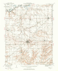
1932 Map of Nashville
USGS Topo · Published 1969About this map
Nashville serves as the focal point of this survey, situated at the junction of the Louisville and Nashville Railroad and the Missouri Pacific Railroad. The landscape is a dense network of early 20th-century rural infrastructure, characterized by an exceptionally high frequency of country schools and churches that speak to the established agricultural communities of Washington County. To the north, the Kaskaskia River snakes across the terrain, creating a series of oxbow features including Big Forked Lake and Round Lake. The map details the transition from the river bottomlands to the upland prairies, where small settlements like New Minden and Hoyleton are linked by State Highway No 177. Genealogists will find particular value in the numerous family-named landmarks and institutions, such as Locust Creek Cem and the myriad of one-room schoolhouses like Hogshead Sch and Halfacre Sch that once anchored these townships.
Find a feature on this map
101 named features on this map. Tap any name to fly to it.
Don’t see what you’re looking for? This feature index may not catch every label — zoom into the map to look around manually.
Map Details
Editions of this 1932 Nashville Map
2 editions found

Other maps of this area

1906 · Breese
USGS Topo · 1:62,500

1907 · Breese
USGS Topo · 1:62,500

1910 · Carlyle
USGS Topo · 1:62,500

1910 · Okawville
USGS Topo · 1:62,500

1914 · Centralia
USGS Topo · 1:62,500

1914 · Coulterville
USGS Topo · 1:62,500

1917 · Coulterville
USGS Topo · 1:62,500

1924 · Pinckneyville
USGS Topo · 1:62,500

1926 · Pinckneyville
USGS Topo · 1:62,500

1926 · Duquoin
USGS Topo · 1:62,500