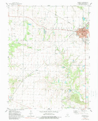
1974 Map of Nashville
USGS Topo · Published 1989About this map
Nashville serves as the focal point of this Washington County survey, showing a well-established grid of streets including Washington St and Elm St centered around the Courthouse and Post Office. The surrounding landscape is a mix of agricultural land and resource extraction, notably the Oil Field and Quarry located west of the city. Industrial and transit lines are prominent, with the Louisville and Nashville and Missouri Illinois railroads intersecting at the town's core.
Find a feature on this map
54 named features on this map. Tap any name to fly to it.
Don’t see what you’re looking for? This feature index may not catch every label — zoom into the map to look around manually.
Map Details
Editions of this 1974 Nashville Map
2 editions found
Other maps of this area

1910 · Okawville
USGS Topo · 1:62,500

1914 · Coulterville
USGS Topo · 1:62,500

1917 · Coulterville
USGS Topo · 1:62,500

1924 · Pinckneyville
USGS Topo · 1:62,500

1926 · Pinckneyville
USGS Topo · 1:62,500

1931 · Hoyleton
USGS Topo · 1:48,000

1932 · Nashville
USGS Topo · 1:62,500

1936 · Nashville
USGS Topo · 1:62,500

1940 · Okawville
USGS Topo · 1:62,500

1958 · Belleville
USGS Topo · 1:250,000